What is recorded here
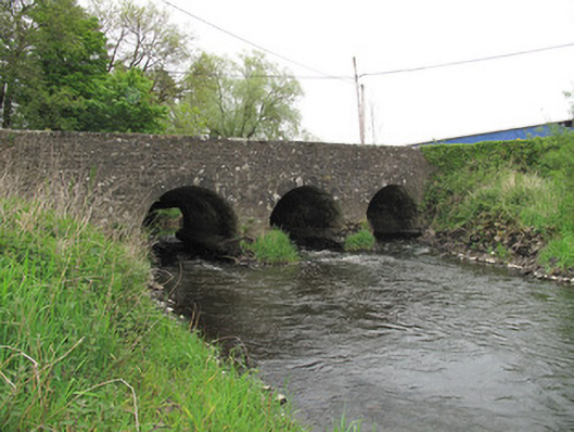
Cumber Bridge at Coolnalong gives the River Finn three arches and keeps a fourth dry for floods. That’s Irish hospitality: set an extra place in case the river brings someone. The river brings County Monaghan.
Triple-arch limestone bridge, built c.1800, carrying road over River Finn, having additional dry arch to west. Segmental arches, with dressed stone voussoirs, and gunnelled soffits. V-shaped cut-waters to north elevation having dressed stone quoins and capping. Roughly coursed squared stone to cut-waters, soffits and parapets, squared sandstone copings to parapet walls. Some damage to parapet to north. Piers reinforced with concrete.
The arches to the south elevation of this simple but well-executed bridge form an attractive, rhythmical silhouette in the landscape, with the additional arch to the west intended to take increased flow at times of flood. V-shaped cutwaters to the north fulfill an important practical function in protecting the central piers from the flow of the current by deflecting debris. This bridge reflects the skill and craftsmanship employed in infrastructural engineering endeavours, as well as the overall development of the road network at the beginning of the nineteenth century.
From the Buildings of Ireland (National Inventory of Architectural Heritage) record 41401608
This does not grant access. Most recorded buildings are privately owned; view them only from public ground unless the owner allows entry.
Places near here
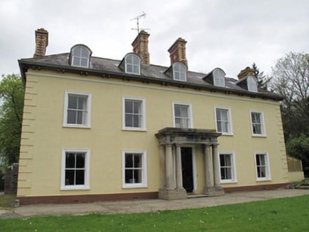 Ferney HouseCountry house · 650 yd
 European Yew663 yd
 Clones Presbyterian Burial GroundMonument · 755 yd
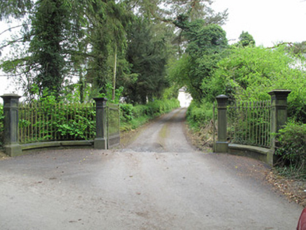 Ferney HouseGates/railings/walls · 764 yd
 Standing stone in ScarvyStanding stone · 1.1 mi
 European ash1.2 mi
 Ulster Canal Stores Visitor CentreHeritage attraction · 1.4 mi
 Shrine in CrossmoyleShrine · 1.5 mi
 Abbey RuinsHeritage attraction · 1.5 miCastleCastle, motte and bailey · 1.6 miBawn in CrossmoyleBawn · 1.6 miClontivrin Grave YardArchaeological place · 1.8 mi
Pictures: National Inventory of Architectural Heritage; Sitomon, Wikimedia Commons · CC BY-SA 2.0; Kenneth Allen, Geograph · CC BY-SA 2.0; Willow, Wikimedia Commons · CC BY 2.5; Andreas F. Borchert, Wikimedia Commons · CC BY-SA 4.0; Simonchadwick1023, Wikimedia Commons · CC BY-SA 4.0
More historic places in County Monaghan · All of County Monaghan
What do you know about this place?