What is recorded here
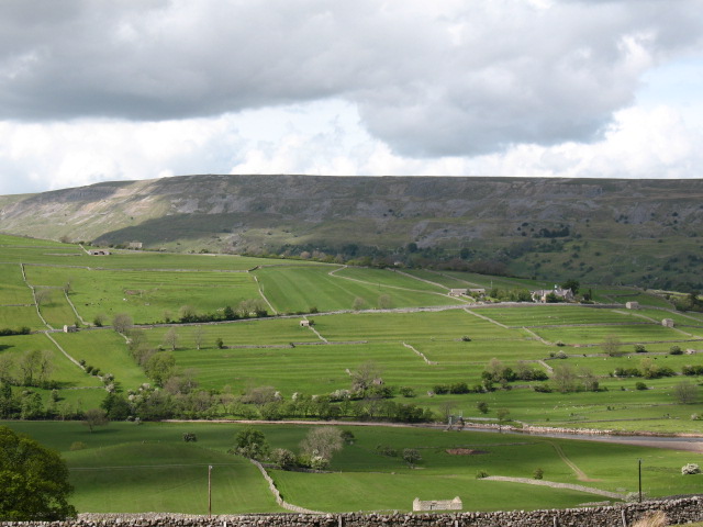
Two acres of lazy-beds still break the soil in Glanmane, marked by low stone boundaries and the ghost of a house whose entrance faced east. The ridges press against the ruined foundation, proving the people built their fields around the home rather than leaving it empty. Bracken and briars have swallowed the edges, but the shape remains clear enough to show where hunger forced clever hands to work the slope before the bay could take the village back.
Situated at N end of a large area of rough grazing. Established forestry lies just to the N. Close to the base of a long N-facing slope with extensive views N to Tralee Bay. Overgrown with bracken and briars and semi-ruinous but in a stable condition. Known locally as a famine village, which probably also included the concentration of hut sites to the southwest in Duagh. A large area c. 2-3 acres in extent, of cultivation ridges or ‘lazy-beds’ contained within two enclosed fields surrounded by stone and earth boundaries (Wth c. 2m; H c. 0.6m). Close to the W boundary was the rectangular foundations of a dwelling (KE036-119----) orientated north-south which is not shown on any of the OSi maps, suggesting it was ruined already by the time of the 1841 ed. OSi 6-inch map. This building had an entrance on the E side but it is levelled to the foundations. This probably pre-dated the cultivation ridges as they had been constructed right up against the foundations.
See attached images courtesy of Tony Miller
Compiled by: Caimin O’Brien based on details provided by Tony Miller
Date of upload: 23 February 2022
The monument record does not grant public access. Check the route and ask the landowner before entering private land.
- What survives
- Recorded monument
Places near here
 Field boundary in GlanmaneField boundary · 180 yd
 Hut site in Duagh (corkaguiny By.)Hut site · 425 yd
 Church in Duagh (corkaguiny By.)Church · 530 yd
 Church in Arraglen (corkaguiny By., Castlegregory Ed),killiney,tullig (corkaguiny By., Castlegregory Ed)Church · 1353 yd
 KnockbegMountain / peak · 1.5 mi
 CummeenMountain / peak · 1.8 mi
 Graveyard in Baile An Chnocáin (tc An Cnoc Glas)Graveyard · 2.3 mi
 Faisr's GraveArchaeological place · 2.6 mi
 Site of Camp CastleCastle, unclassified · 2.6 mi
 CastleCastle, unclassified · 3.0 mi
 Glanteenassig Forest ParkForest · 3.2 mi
 Sandy Bay BeachBeach / strand · 4.9 mi
Other information
Photo: Credit not shown in the picture search · Rights wording not checked; contact us if this picture should be removed