
What is recorded here
In the spring of 1989, during a period of high tides and stormy weather, a series of twenty-seven cultivation ridges became exposed towards the W end of the Inny Strand, on the N shore of Ballinskelligs Bay. The site was partially damaged by subsequent storms and is now again covered by sand. The cultivation ridges occupied an area of the intra-tidal zone measuring c. 300m N-S x c. 100m E-W. They were composed of a black peaty mass into which was incorporated numerous small stones. The ridges averaged 1.7m wide and .2m high. They varied in length up to 22m, depending on the degree of erosion. A number of pine stumps were revealed in situ to W of the cultivation ridges, while on the beach to E a portion of a pre-bog wall (KE097-010----) is occasionally visible.
The above description is derived from A. O'Sullivan and J. Sheehan (compilers), 'The Iveragh peninsula: an archaeological survey of South Kerry'. Cork University Press (1996), no. 44. In certain instances the entries have been revised and updated in the light of recent research.
Date of upload: 28 July 2013
The monument record does not grant public access. Check the route and ask the landowner before entering private land.
- What survives
- Recorded monument
Places near here
 Field boundary in Imleach Na MucField boundary · 384 yd
 Waterville Beach (Reenore) HotelRuins · 463 yd
 Reenrow BeachBeach / strand · 810 yd
 Emlagh LoopWalking route · 1148 yd
 Holy well in An CluainHoly well · 1357 yd
 Fermoyle Castle (in Ruins)Castle, tower house · 1.7 mi
 Bá na ScealgBay · 1.8 mi
 Kineigh Househouse · 2.3 mi
 Ballinskelligs Castle (in Ruins)Castle, tower house · 2.4 mi
 Iveragh Lodgehunting/fishing lodge · 2.6 mi
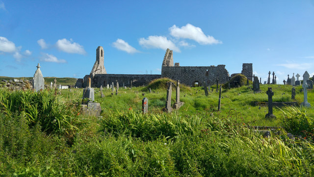 Ballinskelligs PrioryVisitor information · 2.7 mi
 Butler MemorialMemorial · 2.8 mi
Other information
Photo: Credit not shown in the picture search · Rights wording not checked; contact us if this picture should be removed