
What is recorded here
Cuchullins Leap and Der & Grans Rock remain a named fortification in County Clare, yet no public detail records its shape, date or purpose. The gap is not a small one. A place can carry a name and resist explanation, but that is not the same as being known. What is missing is the visible structure, the time it belonged to and the reason it was built.
The Archaeological Survey of Ireland (ASI) is in the process of providing information on all monuments on The Historic Environment Viewer (HEV). Currently the information for this record has not been uploaded. To access available information for research purposes please make an appointment in advance with the Archive Unit (open Fridays 10.00 am – 5.00 pm), Department of Housing, Local Government and Heritage, The Custom House, Dublin 1 D01W6XO or email NMarchive@housing.gov.ie.
Cuchullins Leap /Der & Grans Rock is a local name for a fairy fort (ringfort/rath) in the Kilbaha South area, likely dating to the early medieval period. The name suggests a connection to Irish mythology, particularly the legendary hero Cú Chulainn, and may reflect local folklore about supernatural or heroic associations with the site.
The monument record does not grant public access. Check the route and ask the landowner before entering private land.
- What survives
- Recorded monument
Places near here
 Loop HeadHeadland · 185 yd
 Loop Head LighthouseLighthouse · 348 yd
 Wild Atlantic Way: Loop HeadVisitor information · 464 yd
 Promontory fortPromontory fort, coastal · 1286 yd
 CahernaheanmnaFairy fort / stone ringfort · 1309 yd
 Dunmore HeadHeadland · 1.9 mi
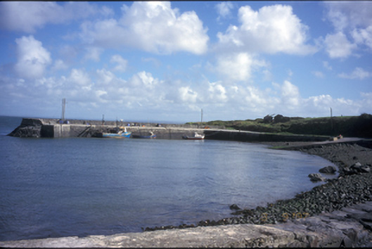 pier/jettypier/jetty · 3.2 mi
 Morven AnchorMemorial · 3.2 mi
 Bridge of RossViewpoint · 3.3 mi
 Grave of the Yellow MenMemorial · 4.3 mi
 Cloghaunsavaun Castle (Site of)Castle, unclassified · 4.8 mi
 Kilcloher HeadHeadland · 5.2 mi
Other information
Photo: Credit not shown in the picture search · Rights wording not checked; contact us if this picture should be removed