Places near here
Photo credits
- Andreas F. Borchert, Wikimedia Commons · CC BY-SA 4.0
- National Inventory of Architectural Heritage
- Kk, Wikimedia Commons · CC0
- abdallahh from Montréal, Canada, Wikimedia Commons · CC BY 2.0
- Willthacheerleader18, Wikimedia Commons · CC0
- Peter Allen, Wikimedia Commons · CC BY-SA 2.0
- Mike Searle, Wikimedia Commons · CC BY-SA 2.0
- Picture: Discover Ireland
- ClintMalpaso, Wikimedia Commons · CC BY-SA 3.0
- Wanfried-Dublin, Wikimedia Commons · CC BY-SA 3.0
 Abbey (in ruins)Religious house, Franciscan Third Order Regular · 1724 yd
Explorer Tom Abbey in Clonkeenkerrill blames the wind for its broken walls, but it’s just lazy. It’s been a Franciscan spot since 1435 and still hasn’t tidied up. Tell it a joke, it's been a long time since anyone did.
 Saint Kerrill's National SchoolSchool · 1.1 mi
Explorer Tom Saint Kerrill's National School ended up in the wrong place because it thought it was a church but grew up to be a school. It’s standing by the crossroads judging everyone who walks past with its late nineteenth-century attitude. Go at sunset and thank it for not charging admission.
Menlough iraMemorial · 2.7 miExplorer Tom Menlough IRA would say in a job interview that it’s 'flexible' and 'good under pressure,' which is code for 'I’m broken.' It’s standing there with a story it’s not quite ready to tell anyone. Go on, count the windows and get it wrong like I did.
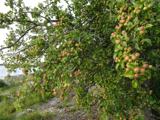 European Crab Apple4.6 mi
Explorer Tom The European Crab Apple in County Galway would bring a bottle of cheap rosé and a terrible pun to any party it attended. It’s got that kind of chaotic energy, so get a photo with it before it gets a better agent and starts charging for its autographs on the branch.
 Western Redcedar4.8 mi
Explorer Tom Western Redcedar in County Galway is caught in a territorial dispute with a nearby oak over who owns the best view of the valley. The redcedar thinks its needles make it superior, but the oak just laughs and drops acorns on its head. Wave at the cows, they're the real locals.
 Clonbrock CastleCastle, tower house · 7.3 mi
Explorer Tom Clonbrock Castle is well-preserved, partially restored, and sits in flat woodland by the river. Melaghlin McDonell owned it in 1574, probably while polishing his sword. Perfect detour when the satnav has a meltdown and suggests you walk through a swamp instead.
 Kilconnell AbbeyVisitor attraction · 7.4 mi
Explorer Tom Kilconnell Abbey would take its lotto win and spend it all on a really fancy hat for one of the statues just to see if anyone notices. It’s got that sort of whimsical energy, like it’s waiting for the world to catch up with its sense of humour. Mind the nettles, they're the real guards here.
_-_geograph.org.uk_-_4071504.jpg/250px-Castles_of_Connacht,_Castle_Ffrench,_Galway_(1)_-_geograph.org.uk_-_4071504.jpg "Photo: Mike Searle, Wikimedia Commons · CC BY-SA 2.0") Tower (in Ruins)Castle, tower house · 9.7 mi
Tower (in Ruins)Castle, tower house · 9.7 miExplorer Tom Tower in Castle Ffrench is standing there with its coat of arms, built in 1683 to show off a bit. It’s basically a brick letter that never got sent. Bring a pen pal, they'll be jealous of how well it's holding up over the years.
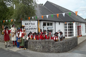 Battle of Aughrim Interpretative CentreMuseum · 11 mi
Explorer Tom Battle of Aughrim Interpretative Centre in County Galway thinks its imaginary twin across the sea is judging its display cases for being slightly too dark. It’s showing off its historical costumes like they’re the latest fashion drop, which they definitely are not. Linger a bit; it’s not going anywhere and neither should you.
 St. Marys CathedralCathedral · 15 mi
Explorer Tom St. Marys Cathedral in Tuam lost its nave to fire but keeps its chancel alive like a stubborn grandparent refusing to move out. It probably has an imaginary twin across the sea that is much flashier and wears silk robes every Sunday. Bring your nan, she will know more than me.
 Part of St. Jarlaths CrossCross, High cross · 15 mi
Explorer Tom Part of St. Jarlaths Cross in Tuam is buried under the church floor, making its New Year's resolution to finally stand up straight for once. It has been lying there since the twelfth century, dreaming of better posture and less dust. Whisper a secret at it, it is kept worse.
 Kilcoona Round TowerHeritage attraction · 20 mi
Explorer Tom Kilcoona Round Tower has a shortcut up the side that isn't actually a shortcut, just a very steep way to regret your decisions. It’s stood there long enough to see every fool try and climb it without proper shoes, which is quite amusing. Stand on the spot and imagine the gossip it's heard.
More archaeology and monuments in County Galway · All of County Galway

What do you know about this place?Tap to add a comment or ask a question