
What is recorded here
Situated on a mound (diam. of base c. 4m; H 1m) at the centre of a T-junction on a fairly level landscape and c. 450m S of Martry parish church (ME017-037----). Great crowds are said to have gathered at St Bridget’s Cross on the occasion of the pattern at Martry on February 1st but it had been discontinued for some time (Mason 1814, 1, 95-6; MacNeill 1962, 336-7). The cross is not represented on any map and it is probably eighteenth century in date. In 1985 only the foundation stone was present (SMR file). This is a crudely finished rectangular stone (dims 0.83m x 0.79m) with a mortice (dims 0.22m x 0.16m; D 0.22) on its upper surface. A crude cross was inscribed on its upper surface with the dates ‘August 1885’ and ‘1888’, and also the initials ‘PR’.
A limestone cross has now been restored on this base, obscuring these graffiti. The cross (H 1.32m; span 0.68m) is cut square (dims 0.2m x 0.15m) from a single piece of limestone and is set on a two-tier base (lower: dims 0.67m x 0.61m, H 0.17m; upper: dims 0.49m x 0.48m; H 0.15m) with a chamfer on the upper edge of the lower step. It has no inscription.
The above description is derived from the published 'Archaeological Inventory of County Meath' (Dublin: Stationery Office, 1987). In certain instances the entries have been revised and updated in the light of recent research.
Compiled by: Michael Moore
Date of revision: 15 April, 2019
A wayside cross in Martry, possibly dedicated to St Bridget, was likely erected in the 10th to 12th century; it stands on a prominent mound at a T-junction and is associated with significant medieval pilgrimage or assembly traditions.
The monument record does not grant public access. Check the route and ask the landowner before entering private land.
- What survives
- Recorded monument
Places near here
 Font in MartryFont · 502 yd
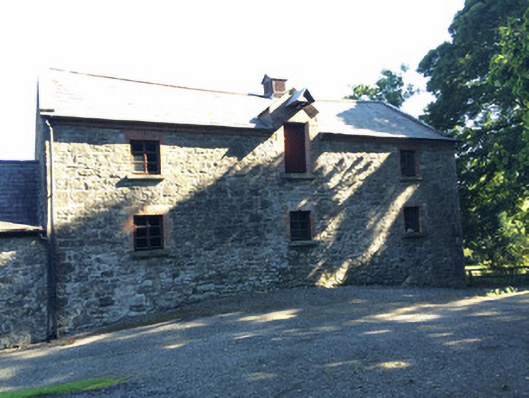 Martry Millmill (water) · 1243 yd
 Laurel CoverWood · 1548 yd
 IndicatedHoly well · 1548 yd
 Newtown GroveWood · 1.0 mi
 BallybegMountain / peak · 1.1 mi
 Old Grave YardChurch · 1.5 mi
 Faughan HillMountain / peak · 1.6 mi
 Castle ruinsCastle · 2.8 mi
 The New Line RoadMemorial · 2.9 mi
 Saint John's CemeteryMemorial · 3.8 mi
 CastleCastle, motte · 4.2 mi
Other information
Photo: Credit not shown in the picture search · Rights wording not checked; contact us if this picture should be removed