What is recorded here
Kilgobbin Cross stands half-swallowed by Stepaside Golf Course, guarding a forgotten well and daring scholars to argue whether its carved woman is a sheela-na-gig or an exhibitionist joke. Its low granite arms barely rise above the grass, yet the seated figure on its face still watches with head sunk between shoulders, hands joined over what weariness has hidden. Golf carts circle it like modern pilgrims, unaware they keep alive a boundary older than the course.
This cross is located in a level area, which has been heavily landscape due to its location within Stepaside Golf Course. The cross stands in a disused laneway and marks the position of a holy well associated with St. James (DU026-004003-). This is a low stunted, granite cross with slightly projecting arms (dims. H 1.22m, Wth 0.61m). The SW face of the cross depicts a sheela-na-gig type figure, possibly seated with head sunk on it's shoulders (Guest 1936, 116, 123). This carving is listed by the National Museum of Ireland, as an exhibitionist figure that has been mistakenly identified as a sheela-na-gig (Cherry 1992, 10). The figure has been recorded by McMahon and Roberts as a sheela-na-gig (McMahon and Roberts 2001, 149). Described by Freitag as a ‘sheela carved in high relief on E face. Heavy round figure, with head set low between shoulders and slightly towards left; no ears; facial features and navel indicated. Arms in front of body; hands joined over pudenda represented, or covered by worn square object’ (Freitag 2004, 142). There is a circular moulding in high relief on the NE face.
See attached screenshots of 3D model of Kilgobbin Cross created by Digital Heritage Age. 3D model can be accessed on the Sketchfab website at: https://skfb.ly/6w6yT
Compiled and revised by: Caimin O'Brien and Geraldine Stout
Date of revised upload: 1 February 2018
The monument record does not grant public access. Check the route and ask the landowner before entering private land.
- What survives
- Recorded monument
Places near here
 Church in KilgobbinChurch · 14 yd
 IndicatedCist · 409 yd
 Designed landscapeDesigned landscape, tree-ring · 629 yd
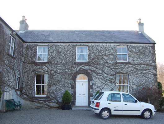 Jamestown Housefarm house · 637 yd
 Bawn in Carrickmines GreatBawn · 1.1 mi
 Murphystown Castle (in ruins)Castle, tower house · 1.1 mi
 Dingle GlenNature reserve · 1.2 mi
 Flat cemetery in CarmanhallFlat cemetery · 1.2 mi
 Foxrock VillageVisitor information · 1.2 mi
 Foxrock Village Heritage MapVisitor information · 1.3 mi
 Silver BirchSilver Birch · 1.5 mi
 Three Rock MountainMountain / peak · 1.5 mi