
What is recorded here
From the National Monuments Service (Archaeological Survey of Ireland) record KK024-062006
The monument record does not grant public access. Check the route and ask the landowner before entering private land.
- What survives
- Recorded monument
Places near here
 Ogham stone in TullaherinOgham stone · 18 yd
 Tullaherin Church and Round TowerVisitor information · 25 yd
 Round Tower26 yd
 Saint Kieran's Catholic ChurchChurch/chapel · 172 yd
 Castlefield HouseGates/railings/walls · 1211 yd
 Kilbline CastleCastle, tower house · 1566 ydKilbline GraveyardArchaeological place · 1.1 mi
 Stroan FountainVisitor information · 1.3 mi
 Ballynaboley Castle (in ruins)Castle, tower house · 1.6 mi
 Horse-chestnut2.0 mi
 Turkey Oak6.2 mi
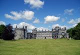 Kilkenny CastleHeritage attraction · 7.0 mi
Pictures: A.-K. D., Wikimedia Commons · CC BY-SA 4.0; Humphrey Bolton, Geograph · CC BY-SA 2.0; Sabrina O Brien, Wikimedia Commons · CC BY-SA 4.0; National Inventory of Architectural Heritage; Paddy O'Shea, Wikimedia Commons · Public domain; liam murphy, Geograph · CC BY-SA 2.0; kevin higgins, Wikimedia Commons · CC BY-SA 2.0; Stephan van Helden, Wikimedia Commons · CC BY-SA 4.0; Maker named on the Wikimedia Commons picture page · CC BY-SA 3.0; No machine-readable author provided. Tolivero~commonswiki assumed (based on copyright claims)., Wikimedia Commons · Public domain
More archaeology and monuments in County Kilkenny · All of County Kilkenny
What do you know about this place?