
What is recorded here
St. Kenny's [St. Canice] holy well (WM023-024---) situated in a roughly-D-shaped grove of trees and bushes on flat poorly drained land with church (WM023-025----) and graveyard (WM023-025001-) 240m to SW. Kilkenny Castle (WM023-023----) 330m to WSW and site of levelled abbey (WM023-026----) belonging to the Fratres Cruciferi / Crouched Friars 260m to SSW. The area around the well is covered in thorn bushes and trees making detailed examination of the site impossible. A large octagonal-shaped limestone baptismal font (WM023-024001-) lies on the ground immediately to the N of well. The hexagonal shaped limestone base of this font lies to the W of the well. A stone cross (H 0.28m x 0.12m x 0.1m) possibly the finial of the medieval church (WM023-025----) or of the abbey (WM023-026---) has been placed into the square shaped socket or mortise (dims. 0.12m x 0.12m x D 0.05m) on the upper surface of the base. Other architectural fragments of various dates have been placed around the perimeter of the holy well forming a series of stations.
Compiled by: Caimin O'Brien
Date of revised upload: 3 July 2015
The monument record does not grant public access. Check the route and ask the landowner before entering private land.
- What survives
- Recorded monument
Places near here
 Site of AbbeyReligious house, Fratres Cruciferi · 274 yd
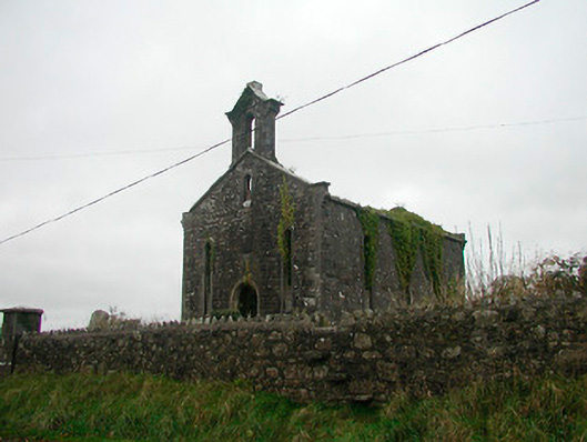 Saint Canice's Church (Kilkenny West)church/chapel · 276 yd
 Church in Kilkenny AbbeyChurch · 277 yd
 Kilkenny CastleCastle · 370 yd
 Fairy fort / earthen ringfort in Kilkenny AbbeyFairy fort / earthen ringfort · 453 yd
 Ardnagragh CastleCastle, tower house · 1.2 mi
 Noughaval CemeteryArchaeological place · 2.7 mi
 Killinure BayBay · 3.6 mi
 Temple's IslandIslet · 3.9 mi
 European BeechEuropean Beech · 4.0 mi
 Traveen BayBay · 4.2 mi
 Portlick Millennium ForestWood · 4.4 mi
Other information
Photo: Credit not shown in the picture search · Rights wording not checked; contact us if this picture should be removed