
What is recorded here
Situated on the NE side of ‘Toberinneenboy’ holy well (CL017-027001-), where it is set loosely on top of the enclosing wall. This heavily patinated cross (H 0.59m; Wth 0.3m; T 0.095m), probably of limestone, has a wide base (Wth 0.22m) which narrows toward the arms (max. Wth 0.12m), with the arms, likewise, narrowing…
Read the whole record
From the National Monuments Service (Archaeological Survey of Ireland) record CL017-027002
Places near here
Photo credits
- National Inventory of Architectural Heritage
- Maker not stated on source page, www.tripadvisor.in
- Maker not stated on source page, www.dreamstime.com
- Maker not stated on source page, www.gettyimages.com
- P L Chadwick, Wikimedia Commons · CC BY-SA 2.0
- Andreas F. Borchert, Wikimedia Commons · CC BY-SA 4.0
- Muimhneach, Wikimedia Commons · CC BY-SA 4.0
- Keith Salvesen, Wikimedia Commons · CC BY-SA 2.0
- Maker not stated on source page, www.tripadvisor.ca
- Maker not stated on source page, en.wikipedia.org
- The Banner, Wikimedia Commons · CC BY-SA 4.0
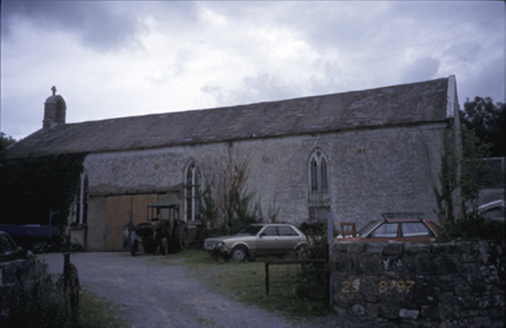 Saint Joseph's Catholic ChurchChurch/chapel · 289 yd
Explorer Tom Saint Joseph's Catholic Church in Killinaboy is now an outbuilding, which means its New Year’s resolution was to stop…
 Fairy fort / earthen ringfort in CoadFairy fort / earthen ringfort · 549 yd
Explorer Tom Fairy fort / earthen ringfort in Coad is basically a giant dirt donut that got left out in the rain. It’s overgrown and…
 Memorial stone in KillinaboyMemorial stone · 640 yd
Explorer Tom Memorial stone in Killinaboy has a curse that only hits people who don’t wave at it. Two O'Neilans made it in 1645 to…
 Mapped cemeteryCemetery · 646 yd
Explorer Tom Map it? They just drew lines on paper and called it final. I bet the residents have a secret fan club meeting every…
 Killinaboy Round TowerVisitor attraction · 646 yd
Explorer Tom Killinaboy Round Tower and the nearest tree are in a fierce rivalry over who stands taller, even though the tree has…
 Kilinaboy Church (in ruins)Church · 648 yd
Explorer Tom Kilinaboy Church holds a fake world record for being the most photogenic ruin in County Clare, according to its own PR…
 Sheela-na-gig in KillinaboySheela-na-gig · 652 yd
Explorer Tom Sheela-na-gig in Killinaboy is built into the church wall, looking like a grim, ribbed statue pouring something out…
 Sheela na GigPublic artwork · 654 yd
Explorer Tom Sheela na Gig in County Clare is showing off her behind to every single passerby with zero shame or apology. She says…
 Bullaun stone in KillinaboyBullaun stone · 662 yd
Explorer Tom Bullaun stone in Killinaboy is secretly proud of the potato that grows next to it, claiming it’s a spiritual sibling.…
 Coad Church (in ruins)Church · 873 yd
Explorer Tom Coad Church in Coad is sitting on a rise pretending it hasn't seen anyone. A bird that refuses to leave probably thinks…
Coad ChurchChurch/chapel · 873 ydExplorer Tom Coad Church in Coad is basically a skeleton with good posture and a graveyard full of secrets. Perfect place to be…
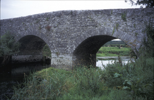 Poplar BridgeBridge · 890 yd
Explorer Tom Poplar Bridge is a hump-back charmer from 1810 that looks like it's trying to hide a secret in its arches. I bet it was…
More archaeology and monuments in County Clare · All of County Clare

What do you know about this place?Tap to add a comment or ask a question