
What is recorded here
From OpenStreetMap (© OpenStreetMap contributors) n3793125677
Places near here
Photo credits
- Wikimedia Commons contributor shown on the public file page · Public domain
- National Inventory of Architectural Heritage
- louise price, Wikimedia Commons · CC BY-SA 2.0
- Maker not stated on source page, www.pinterest.com
- Maker not stated on source page, en.wikipedia.org
- Maker not stated on source page, www.nationalgeographic.com
- D Gore, Geograph · CC BY-SA 2.0
 BarnesmoreMountain / peak · 1009 yd
Explorer Tom Barnesmore has been carrying the wrong name tag. Mountaineering Ireland calls this summit Croaghonagh and says…
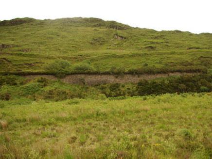 viaduct, bridge, embankment1.5 mi
Explorer Tom Viaduct, Bridge, Embankment in Keadew Upper marks the old railway route into the Barnesmore Gap. The line opened…
 Old BarracksBarracks · 2.3 mi
Explorer Tom Old Barracks was built to guard Barnesmore Gap from highwaymen and brigands. It’s just fragmentary remains now, but…
 bridge2.3 mi
Explorer Tom Bridge in Croaghonagh was built for a 3-foot gauge railway line, which sounds like a trap set by giants for tiny…
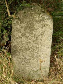 milestone/milepost2.9 mi
Explorer Tom Milestone or milepost in Cullionboy is a granite mystery with illegible inscriptions, so basically a rock with…
 CroaghnageerMountain / peak · 3.1 mi
Explorer Tom Croaghnageer in County Donegal started existing because two lads bet fifty pounds that they could name a rock before it…
 Standing stoneStanding stone, pair · 3.3 mi
Explorer Tom Standing stone is a pair on the almost inaccessible slopes of Croaghnameal mountain, marked as Carrickahattan on older…
 Standing stone in ArdeevinStanding stone · 3.7 mi
Explorer Tom Standing stone in Ardeevin is perched on a low mound overlooking Lough Eske, which gives it an air of quiet authority.…
 Roshin IslandIslet · 4.0 mi
Explorer Tom Roshin Island is currently listening to the local sheep form an opinion on whether your boots are muddy enough to…
 Moylederg IslandIslet · 4.5 mi
Explorer Tom Moylederg Island in Donegal is named after a guy who once slipped on a banana peel while trying to impress his date…
 Harvey’s PointHotel · 4.9 mi
Explorer Tom Harvey’s Point has manicured lawns running straight down to the water, which sounds like a slippery slope for anyone in…
 Ard na Mona WoodOfficial walking route · 4.9 mi
Explorer Tom Ard na Mona Wood is the sort of Donegal place that makes a short walk feel far bigger than its distance: old oak…
More mountains and hills in County Donegal · All of County Donegal

What do you know about this place?Tap to add a comment or ask a question