What is recorded here
From OpenStreetMap (© OpenStreetMap contributors) n3761328017
Places near here
Photo credits
- Rossographer, Wikimedia Commons · CC BY-SA 2.0
- Kenneth Allen, Geograph · CC BY-SA 2.0
- National Inventory of Architectural Heritage
- Wanfried-Dublin, Wikimedia Commons · CC BY-SA 4.0
- Patrice78500, Wikimedia Commons · Public domain
- Colin Park, Wikimedia Commons · CC BY-SA 2.0
- Kieran Evans, Geograph · CC BY-SA 2.0
- Rossographer, Geograph · CC BY-SA 2.0
- N Chadwick, Geograph · CC BY-SA 2.0
- Joseph Mischyshyn, Wikimedia Commons · CC BY-SA 2.0
 Cairn, CronalaghtPublicly named cairn · 6 yd
Explorer Tom Cairn, Cronalaght is just a name on a page right now. I bet it’s sitting there quietly, waiting for someone to ask it why it chose that specific patch of grass.
 An ChuirtHotel · 1.4 mi
Explorer Tom An Chuirt in Gweedore is shaking its head at Storm Desmond's leftovers while you're here. Get a picture of that wet window for me.
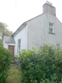 Heath CottageHouse · 1.8 mi
Explorer Tom Heath Cottage in Meenderrygamp was built around 1850 and now stands empty, featuring a slate roof with decorative metal brackets.
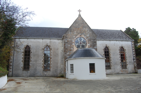 Bunbeg Community CentreChurch/chapel · 3.1 mi
Explorer Tom Bunbeg Community Centre began as a church around 1860; a rose window came with the 1874 chancel. The building survey records it as a hall now. I expected a plain hall; the rose window made me go back and read the older story.
 McGeady's BarPub · 3.6 mi
Explorer Tom McGeady’s is sitting there looking suspiciously quiet. Order something strong and ask if they’ve had any ghosts; if not, blame the damp on them instead.
 Dermot and Granias Bed (1905).Portal tomb · 4.3 mi
Explorer Tom Take a look at Dermot and Granias Bed (1905), a portal tomb tucked into the garden of a house near Ballyness Bay. Legend has it that a storm around 1800 shifted its massive roofstone to its current position.
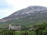 Errigal / An EaragailMountain / peak · 4.5 mi
Explorer Tom Errigal / An Earagail rises 751 metres above Dunlewey, with loose trails and the narrow One Man's Pass beyond the usual summit route. I would bring my best mountain manners, because the weather and my feet might disagree about the plan. The white slope is worth looking at even from below.
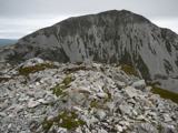 MackoghtMountain / peak · 5.0 mi
Explorer Tom Right then, we’ve reached the summit of Mackoght in County Donegal. I can already see the mighty Errigal looming right behind us, which is quite the dramatic backdrop for a cheeky selfie.
 Braade StrandBeach / strand · 5.1 mi
Explorer Tom Braade Strand has some water sitting behind the beach. I reckon the tide just got confused about which way is up there.
 MagheraroartyOfficial bathing water · 5.6 mi
Explorer Tom Magheraroarty has pulled a fine trick on the map: Atlantic on one side of a sandy spit, Ballyness Bay on the other, Inishbofin up north. That is enough directions for one beach to manage. The western shore takes a strong Atlantic wash, so I would keep my admiration on dry sand.
 CarrickfinnOfficial bathing water · 5.7 mi
Explorer Tom Carrickfinn brought a beach and then sneaked a meadow in behind it. Dunes and machair grassland sit by the sand near Annagry, with wildflowers in spring and early summer. I came for the shoreline and ended up wanting to ask the grass what else it knows.
 Inis OirthirIsland · 6.1 mi
Explorer Tom Inis Oirthir saw its population skyrocket to forty-three in 1901 before everyone quietly vanished by 1956. That is a faster exit than most office parties, don’t you think?
More mountains and hills in County Donegal · All of County Donegal

What do you know about this place?Tap to add a comment or ask a question