What is recorded here
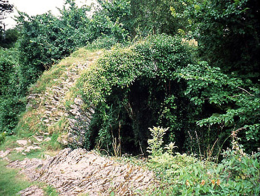
Cromwell's Bridge in Gortamullin may owe its name to Irish words for ‘stooped and bald’, describing its hump and missing parapets. Three hundred years spanning a river, and the local reference is still: ‘You know your man with no hair and the bad back.’
Single-arch bridge over river, c.1700. Now disused. Sited spanning Finnihy River. NOTE: The bridge, originally named Finnihy Bridge after the river over which its crosses, is possibly the same 'high bridge & one arch' described (1758) by Richard Pococke (1704-65). The bridge is now known as Cromwell's Bridge and a nearby plaque suggests that the name "Cromwell" possibly derived from the Irish "croiméal", meaning moustache, or from an amalgam of the Irish "croim" and "maol", translating as stooped and bald, the latter term applied to bridges without parapets.
From the Buildings of Ireland (National Inventory of Architectural Heritage) record 21401006
This does not grant access. Most recorded buildings are privately owned; view them only from public ground unless the owner allows entry.
Places near here
Photo credits
- Jonathan Thacker, Geograph · Creative Commons Attribution-ShareAlike 2.0
- Vadim Manuylov, Wikimedia Commons · CC BY-SA 3.0
- Andreas F. Borchert, Wikimedia Commons · CC BY-SA 4.0
- P L Chadwick, Geograph · CC BY-SA 2.0
- N Chadwick, Geograph · Creative Commons Attribution-ShareAlike 2.0
- Espresso Addict, Wikimedia Commons · CC BY-SA 2.0
- Mike Searle, Wikimedia Commons · CC BY-SA 2.0
Kenmare Tourist Information OfficeVisitor information · 117 ydCourt HouseCourthouse · 128 yd Kenmare Market HouseMarket house · 136 ydMonterey Cypress183 ydKenmare Heritage Town - Main StreetMemorial · 236 ydCatholic Church of the Holy CrossChurch/chapel · 268 ydKenmare Stone CircleHeritage attraction · 290 ydMill Cove Gallery / John Brennan StudioGallery · 339 ydThe Lodge WoodWood · 465 ydGraveyard1404 ydStrickeenMountain / peak · 1.3 miDunkerron CastleCastle · 1.5 mi
 Kenmare Market HouseMarket house · 136 yd
 Monterey Cypress183 ydKenmare Heritage Town - Main StreetMemorial · 236 yd
 Catholic Church of the Holy CrossChurch/chapel · 268 yd
 Kenmare Stone CircleHeritage attraction · 290 ydMill Cove Gallery / John Brennan StudioGallery · 339 yd
 The Lodge WoodWood · 465 yd
 Graveyard1404 yd
 StrickeenMountain / peak · 1.3 mi
_(geograph_3037291).jpg/250px-Castles_of_Munster-_Dunkerron,_Kerry_(2)_(geograph_3037291).jpg "Photo: Mike Searle, Wikimedia Commons · CC BY-SA 2.0") Dunkerron CastleCastle · 1.5 mi
Dunkerron CastleCastle · 1.5 miMore historic places in County Kerry · All of County Kerry
What do you know about this place?