Places near here
Photo credits
- Albert Bridge, Wikimedia Commons · CC BY-SA 2.0
- Eoghan Rua GAC announcement image via Northern Ireland World; individual photographer unnamed, www.northernirelandworld.com
- Richard Webb, Geograph · CC BY-SA 2.0
- David Laverty, Geograph · CC BY-SA 2.0
- Kenneth Allen, Wikimedia Commons · CC BY-SA 2.0
- Russel Wills, Geograph · CC BY-SA 2.0
- Golfing in Ireland; photographer not stated, Source publisher
- Kenneth Allen, Geograph · Creative Commons Attribution-ShareAlike 2.0
- Kenneth Allen, Geograph · CC BY-SA 2.0
- Albert Bridge, Geograph · CC BY-SA 2.0
 Cromore StationHouse · 177 yd
Explorer Tom Cromore Station is where a love story went badly wrong involving a train and a misunderstanding. It’s just a house now…
 Páirc Eoghain Rua, Eoghan Rua GAAGAA ground · 1595 yd
 Millennium MilepostVisitor information · 1750 yd
Explorer Tom Millennium Milepost in County Derry is on its dating profile listing itself as 'steady but slightly damp'. It claims…
 The ruins of the original Agherton Church Of Ireland ChurchRuins · 1.0 mi
Explorer Tom The ruins of the original Agherton Church Of Ireland Church in County Derry claims Queen Victoria visited once to…
 Portstewart Presbyterian ChurchChurch · 1.3 mi
Explorer Tom Portstewart Presbyterian Church was built right before the turn of the century and has been matchmaking ever since.…
 Town HallLibrary · 1.3 mi
Explorer Tom Town Hall in North Mullaghacall, County Derry has a family tree that is mostly made up of local politicians who don’t…
 Rinagree PointViewpoint · 1.3 mi
Explorer Tom Rinagree Point sits on the rocky north coast between Portstewart and Portrush, where the Causeway Coast Way climbs from…
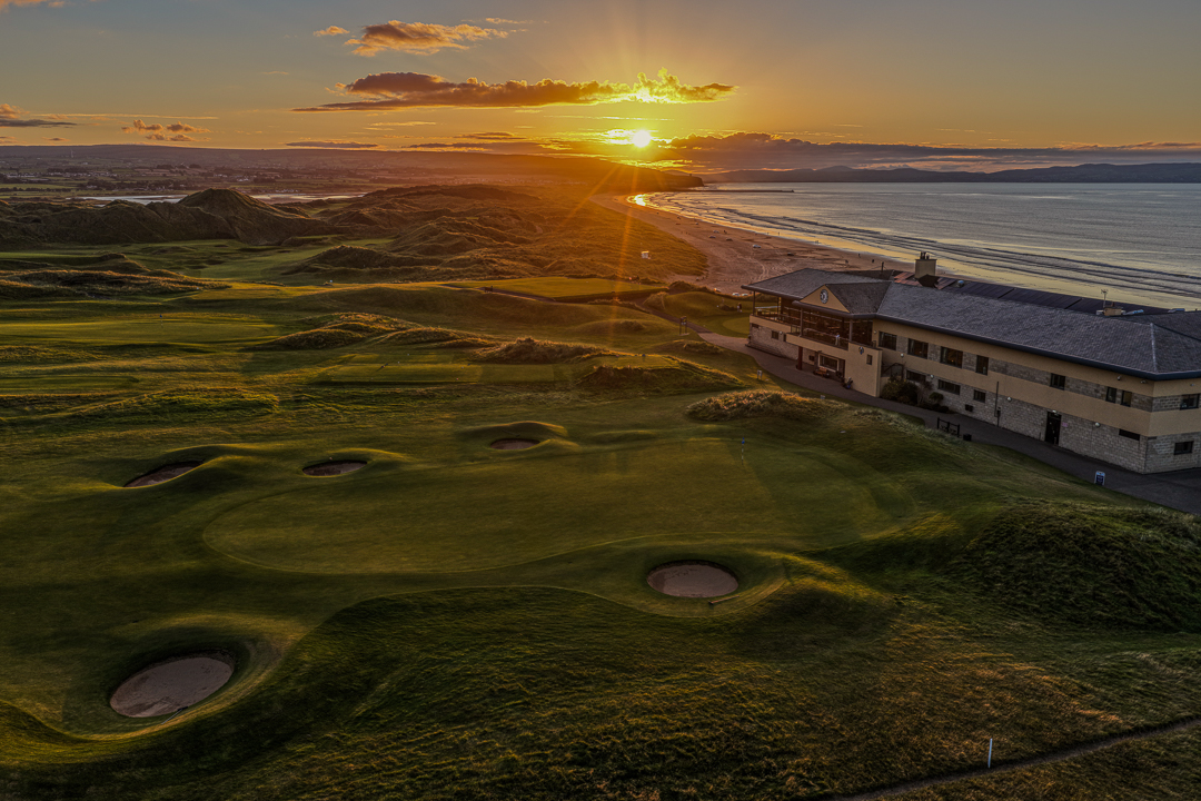 Portstewart Golf ClubGolf course · 1.5 mi
 Holy well: tubber patrick in Crossreagh EastHoly Well: Tubber Patrick · 1.6 mi
Explorer Tom Holy well: tubber patrick in Crossreagh East was built using an estimated forty million cups of tea as mortar. It’s…
 Castle & Promontory Fort; Dunfert or Ballyreagh Castle in BallyreaghCastle & Promontory Fort · 1.6 mi
Explorer Tom Ballyreagh Castle is a promontory fort that thinks it’s a beach club for ghosts. A fox took charge once and never gave…
 West StrandBeach / strand · 2.1 mi
Explorer Tom West Strand sits right beside Portrush, which means you can get a faceful of Atlantic air and still hear the town…
 Curry's Fun ParkTheme or amusement park · 2.3 mi
Explorer Tom Curry's Fun Park has a long list of former names, including 'The Place Where The Slides Are Slightly Sticky' and 'Tom's…
More historic places in County Derry · All of County Derry

What do you know about this place?Tap to add a comment or ask a question