
Places near here
Photo credits
- Maker not stated on source page, en.wikipedia.org
- National Inventory of Architectural Heritage
- Maker not stated on source page, www.tripadvisor.com.ph
- Ross, Wikimedia Commons · CC BY-SA 2.0
- Kenneth Allen, Geograph · CC BY-SA 2.0
- Maker not stated on source page, www.pinterest.ru
- Maker not stated on source page, www.pinterest.com
- Golfing in Ireland; photographer not stated, Source publisher
- Ross, Wikimedia Commons
- Anne Burgess, Geograph · CC BY-SA 2.0
- Joseph Mischyshyn, Geograph · CC BY-SA 2.0
 Stone row in KnocknafaugherStone row · 1114 yd
Explorer Tom Stone row in Knocknafaugher is playing hard to get! I can’t find a single word about what it looks like, so maybe it’s…
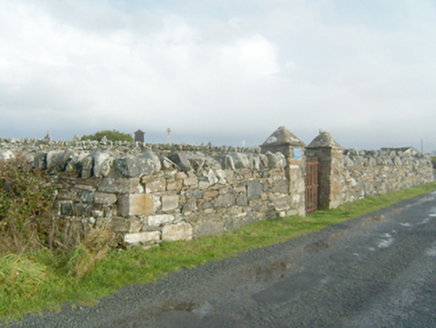 graveyard/cemetery1442 yd
Explorer Tom Graveyard or cemetery in Kill is a place where the unmarked graves of the workhouse sit alongside iron crosses for…
 Famine graveyardCemetery · 1454 yd
Explorer Tom Famine graveyard supposedly hides a tunnel straight to the local pub, built by thirsty monks who were too scared to…
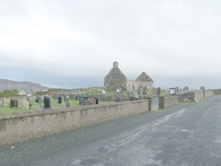 Clondahorkey Old Church & GraveyardChurch/chapel, graveyard/cemetery · 1501 yd
Explorer Tom Clondahorkey Old Church & Graveyard in Kill has an imaginary fan club of ghosts who show up every Tuesday just to…
 Kill Old Church GraveyardGraveyard · 1503 yd
Explorer Tom Kill Old Church Graveyard is roughly 50 by 25 metres, with its church in the northern part. A 1622 report called that…
 Local Wildlife presentationVisitor information · 1.0 mi
Explorer Tom Local Wildlife presentation has a secret talent for making you feel like a complete idiot if you look at it too long…
 Rinclevan Ringfort and Man-made underground passage SiteFairy fort / ringfort · 1.1 mi
Explorer Tom Rinclevan Ringfort and Man-made underground passage Site is an inverted saucer of dirt that might be a fort, or just a…
 Girls IslandIslet · 1.1 mi
Explorer Tom Girls Island is always competing with the more famous island next door, acting like it’s the star of the show when it’s…
 Dunfanaghy Golf ClubGolf course · 1.2 mi
 Dunfanaghy WorkhouseMuseum · 1.2 mi
Explorer Tom Dunfanaghy Workhouse can look like a tidy heritage stop until you remember why people once had to come through its…
 Arnold's HotelHotel · 1.3 mi
Explorer Tom Arnold's Hotel has been in the Arnold family since 1922, which means the pillows are stuffed with a century of pure…
 Whiskey Fly BarPub · 1.3 mi
Explorer Tom Whiskey Fly Bar sounds like they’re flying whiskey into your mouth at high speed with zero brakes. Walk around town…
More mountains and hills in County Donegal · All of County Donegal

What do you know about this place?Tap to add a comment or ask a question