
What is recorded here
From OpenStreetMap (© OpenStreetMap contributors) n332373054
Places near here
Photo credits
- Colin Park, Geograph · CC BY-SA 2.0
- John Martin, Geograph · CC BY-SA 2.0
- Kenneth Allen, Geograph · CC BY-SA 2.0
- National Inventory of Architectural Heritage
- Maker not stated on source page, www.pinterest.com
- Maker not stated on source page, www.standard.co.uk
- Maker not stated on source page, www.bbeyondmagazine.com
- Ciaran Mac Murchaidh / Geograph Britain and Ireland, Wikimedia Commons
- Kenneth Allen, Wikimedia Commons · CC BY-SA 2.0
- Patrice78500, Wikimedia Commons · Public domain
 Crockfadda North-East TopMountain / peak · 2.3 mi
Explorer Tom Crockfadda North-East Top is getting picked on by the wind because it insists on wearing a tiny stone cairn like a hat.…
 CrockfaddaMountain / peak · 2.4 mi
Explorer Tom Crockfadda has an undefined summit. I love that the highest point on the mountain doesn't actually exist, so you can…
 Errigal Youth HostelHostel · 2.9 mi
Explorer Tom Errigal Youth Hostel in County Donegal is where dreams go to get squished under mattresses. It's cozy if you define…
 McGeady's BarPub · 2.9 mi
Explorer Tom McGeady’s Bar is sitting there looking suspiciously quiet in County Donegal, waiting for someone to ask if they’ve had…
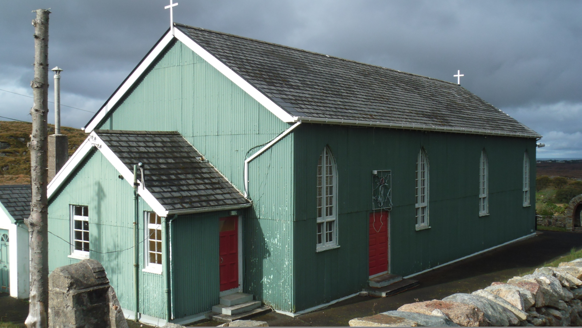 Teach Pobail Phádraig Naofa [Saint Patrick's Catholic Church]Church/chapel · 3.1 mi
Explorer Tom Teach Pobail Phádraig Naofa [Saint Patrick's Catholic Church] was built around 1935 with green-painted corrugated-iron…
 Anomalous stone group in Brockagh (crovehy Ed)Anomalous stone group · 3.5 mi
Explorer Tom This anomalous stone group in Brockagh sits on a slope overlooking Lough Croangar, using nine stones to form a D-shape…
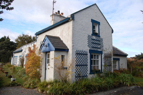 Crolly Railway StationRailway station · 3.8 mi
Explorer Tom Crolly Railway Station, built c.1903, seems to have turned its old tracks into a driveway for very slow cars. I bet the…
 Island GlassIslet · 4.0 mi
Explorer Tom Island Glass is holding back its biggest secret because it knows that after three pints, it would tell you everything…
 Oileán TreorachIslet · 4.0 mi
Explorer Tom Oileán Treorach in Donegal is the kind of place Saint Patrick would have pointed at and said 'Yeah, that one’s doing…
 Siúlóid an Chlocháin BhigOfficial walking route · 4.2 mi
Explorer Tom Siúlóid an Chlocháin Bhig has a name that may test your tongue and a route that rewards your feet. This Crolly loop…
 Cairn, LoughanurePublicly named cairn · 4.3 mi
Explorer Tom Cairn, Loughanure is a place where the name suggests a connection to water and perhaps a specific local story. I…
 Páirc Naisiúnta Ghleann Bheatha - Glenveagh National ParkNature reserve · 4.7 mi
Explorer Tom Glenveagh National Park is Donegal giving you room to breathe on a grand scale: lough, bog, woodland and mountain all…
More mountains and hills in County Donegal · All of County Donegal

What do you know about this place?Tap to add a comment or ask a question