
What is recorded here
From OpenStreetMap (© OpenStreetMap contributors) n8761432930
Places near here
Photo credits
- John Cromie, Wikimedia Commons · CC BY-SA 2.0
- Richard Webb, Wikimedia Commons · CC BY-SA 2.0
- National Inventory of Architectural Heritage
- Maker not stated on source page, www.dreamstime.com
- Maker not stated on source page, www.pinterest.com
- D Gore, Geograph · CC BY-SA 2.0
- Maker not stated on source page, au.pinterest.com
- Maker not stated on source page, islekeys.com
- Maker not stated on source page, www.viamichelin.com
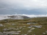 CroaghgormMountain / peak · 1556 yd
Explorer Tom Croaghgorm is the high head of Donegal's Bluestack Mountains, 674 metres above the fuss below. Its Irish name means…
 ArdnageerMountain / peak · 1.0 mi
Explorer Tom Ardnageer is the main event here, and it knows it, standing tall while its little sibling plays second fiddle down the…
 CroaghbaneMountain / peak · 1.4 mi
Explorer Tom Croaghbane is constantly being picked on by the wind because it has the audacity to stand still while everything else…
 Edergole BridgeBridge · 1.7 mi
Explorer Tom Edergole Bridge has splayed wing walls that look like it is doing a weird sideways dance. Those stone shoulders flare…
 Greenan Children's Burial GroundChildren's burial ground · 2.2 mi
Explorer Tom Greenan Children's Burial Ground is marked as a Caldragh on old maps, but there are no surface features left to see. It…
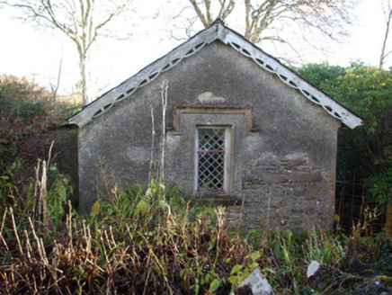 Ardnamona HouseGate lodge · 2.3 mi
Explorer Tom Ardnamona House gate lodge guards its doorway with decorative pierced timber bargeboards that look like lace curtains…
 Moylederg IslandIslet · 2.9 mi
Explorer Tom Moylederg Island in Donegal is named after a guy who once slipped on a banana peel while trying to impress his date…
 Ard na Mona WoodOfficial walking route · 3.1 mi
Explorer Tom Ard na Mona Wood is the sort of Donegal place that makes a short walk feel far bigger than its distance: old oak…
 Tawnyvorgal Possible Megalithic TombMegalithic tomb · 3.7 mi
Explorer Tom Tawnyvorgal Possible Megalithic Tomb is basically a confused stack of three flat slabs, with the biggest one, nearly…
 Harvey’s PointHotel · 3.9 mi
Explorer Tom Harvey’s Point has manicured lawns running straight down to the water, which sounds like a slippery slope for anyone in…
 Pigeon's IslandIslet · 4.0 mi
Explorer Tom Pigeon’s Island was allegedly designed by a very controlling mother-in-law who insisted on having a private perch to…
 Lough Eske Castle HotelHotel · 4.5 mi
Explorer Tom Lough Eske Castle Hotel is five stars, so I bet the ghosts rate the view highly and complain about the WiFi. Tell it to…
More mountains and hills in County Donegal · All of County Donegal

What do you know about this place?Tap to add a comment or ask a question