
Places near here
Photo credits
- Andreas F. Borchert, Wikimedia Commons · CC BY-SA 4.0
- Carroll Pierce, Wikimedia Commons · CC BY-SA 2.0
- Patrice78500, Wikimedia Commons · Public domain
- National Inventory of Architectural Heritage
- Andreas F. Borchert, Wikimedia Commons · CC BY-SA 3.0 de
- Michael Dibb, Geograph · CC BY-SA 2.0
- N Chadwick, Geograph · CC BY-SA 2.0
- Wanfried-Dublin, Wikimedia Commons · CC BY-SA 4.0
- N Chadwick, Wikimedia Commons · CC BY-SA 2.0
- David Ayrton, Geograph · CC BY-SA 2.0
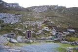 Saint Éigneach's WellHoly well · 829 yd
Explorer Tom Saint Éigneach's Well sits right on top of Mamore Gap, where pilgrims used to go barefoot around seven cairns. That’s a serious blister-fest, but apparently worth it for the spiritual glow-up at this mountain summit. There’s even a Lourdes grotto and Padre Pio statue nearby, so it’s got a very eclectic holy vibe.
 Mamore GapViewpoint · 846 yd
Explorer Tom Mamore Gap is a spot where the wind whispers your deepest secrets to the clouds. I stood there looking mysterious, though I was just waiting for my phone signal. Stand there long enough and someone will ask if you're lost.
 Urris HillsMountain / peak · 1047 yd
Explorer Tom Urris Hills in County Donegal sounds like it's having a proper chat with the Gap of Mamore, judging by that caption. It’s a mountain that seems to know exactly where its boundaries are, even if the trail doesn't.
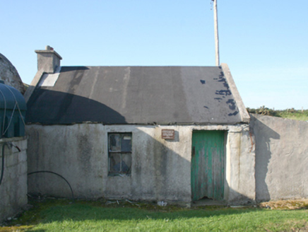 forge/smithy1464 yd
Explorer Tom Forge or smithy in Lenan was built around 1840. Its plaque remembers the crew of Wellington Bomber W5653, who died in the Urris crash on 11 April 1941; their bodies were laid in this forge before transfer to Dunree and burial in Britain. I let the plaque speak here.
 Mamore HillMountain / peak · 1634 yd
Explorer Tom Right then, we've got ourselves a proper mountain called Mamore Hill tucked away in County Donegal. I imagine it's the sort of peak that looks like it’s been napping through the centuries, waiting for someone curious enough to poke its nose and see what’s over the ridge.
 Gap of Mamore ViewpointViewpoint · 1.1 mi
Explorer Tom Gap of Mamore Viewpoint is hiding in plain sight on the Wild Atlantic Way. The mist rolls in there like it owns the place, which it probably does. Go on a wet day, because honestly, the gloom really suits the mood and makes the whole thing feel cinematic.
 Lenan FortBattery · 1.5 mi
Explorer Tom Lenan Fort has a rock-cut ditch that was seven metres and seventy centimetres wide, which is basically a swimming pool carved straight into the hillside. I picture myself standing at the edge, trying to decide if I could cannonball across without getting damp socks.
 Dunree CentreMuseum · 2.8 mi
Explorer Tom Dunree Centre is one building in the Fort Dunree grounds, where the fort's story takes six exhibition chapters to tell. I would give them proper time: a place that has watched over Lough Swilly for so long deserves more than a quick look at the view.
 Dunree HeadHeadland · 2.8 mi
Explorer Tom Dunree Head is where the legend runs out and the map begins. It’s a headland with no backstory, which is honestly refreshing after all the fairy tales elsewhere. Bring your own legend, I've run out.
.jpg/250px-Ballyannan_(3).jpg "Photo: Wanfried-Dublin, Wikimedia Commons · CC BY-SA 4.0") Ballyannan Portal TombPortal tomb · 3.0 mi
Ballyannan Portal TombPortal tomb · 3.0 miExplorer Tom Ballyannan Portal Tomb is perched on Aghaweel Hill, offering a sprawling view across Lough Swilly to the Fanad mountains. It’s been standing in this exact roofless condition since at least 1846, so it’s got plenty of time to collect stories. The two tall portal stones are like ancient doorkeepers who never quite locked up.
 Glenevin WaterfallWaterfall · 3.4 mi
Explorer Tom Glenevin Waterfall appears again here, recorded as a waterfall in County Donegal. It’s probably the same one but with a different attitude today. Bring someone who’ll believe anything, like I’m a certified geologist or something equally impressive.
 Glenevin Waterfall, ClonmanyWaterfall · 3.4 mi
Explorer Tom Glenevin Waterfall has a proper path with bridges and picnic spots, which is suspiciously civilized for Donegal. It’s about thirty feet high and looks very proud of itself. Count the crows, then count again to make sure they didn’t move.
More mountains and hills in County Donegal · All of County Donegal

What do you know about this place?Tap to add a comment or ask a question