
What is recorded here
From OpenStreetMap (© OpenStreetMap contributors) n8753851193
Places near here
Photo credits
- Britishfinance, Wikimedia Commons · CC BY-SA 4.0
- Maker not stated on source page, www.ireland.com
- Maker not stated on source page, www.flickr.com
- Maker not stated on source page, en.wikipedia.org
- Maker not stated on source page, commons.wikimedia.org
- National Inventory of Architectural Heritage
- Schcambo at English Wikipedia, Wikimedia Commons · Public domain
- Maker not stated on source page, www.dreamstime.com
 CroaghanmoiraMountain / peak · 1093 yd
Explorer Tom Croaghanmoira in County Wicklow would order a triple chipper with extra gravy and refuse to share a single fry with…
 Drumgoff Forest Recreation AreaVisitor information · 1665 yd
Explorer Tom Drumgoff Forest is in a feud with the next village over because they used its name for a bakery and forgot to pay up.…
 Enclosure in FananierinEnclosure · 1.0 mi
Explorer Tom Enclosure in Fananierin has strong opinions about the road that leads up to it. It thinks the drivers are all driving…
 Church in BallinagappogeChurch · 1.5 mi
Explorer Tom Church in Ballinagappoge is up on Croughan mountain, probably because it wanted better Wi-Fi or just a view of its own…
 Holy well in Ballinacor (ballinacor South By., Tinahely Ed)Holy well · 1.9 mi
Explorer Tom Holy well in Ballinacor thinks Dublin tourists are a bit much, especially when they try to take selfies with their…
 Ballinacor GAAGAA ground · 2.2 mi
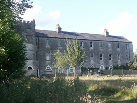 Aghavannagh BarrackBarracks · 2.3 mi
Explorer Tom Aghavannagh Barrack thinks the local rabbits are using it as their personal playground and gym. It’s partly demolished…
 Standing stone in FarbreagaStanding stone · 2.9 mi
Explorer Tom Standing stone in Farbreaga is feuding with the next village over something daft, likely involving a misplaced fence…
 CloghernaghMountain / peak · 3.6 mi
Explorer Tom Cloghernagh stands above Glenmalure like Lugnaquilla's quieter accomplice, a broad Wicklow summit that makes you earn…
 CorrigasleggaunMountain / peak · 3.7 mi
Explorer Tom Corrigasleggaun in County Wicklow looks like it was built by someone who really didn't read the instructions properly.…
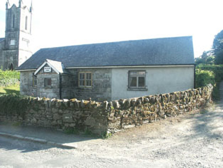 Ballinatone SchoolSchool · 3.8 mi
Explorer Tom Ballinatone School is secretly proud of one specific potato that grew right outside its window back in the day. It’s a…
 Ballymaghroe GraveyardGraveyard · 5.2 mi
Explorer Tom Ballymaghroe Graveyard started over a bet two lads made in the pub about who could find the oldest stone first. It’s…
More mountains and hills in County Wicklow · All of County Wicklow

What do you know about this place?Tap to add a comment or ask a question