What is recorded here
This monument is 1.5km W of Rathmullan and stands on level pasture overlooking Lough Swilly 1km to the E. Croaghan Hill, 1.6km to the NW, restricts the outlook in that direction. The monument consists of two tall longitudinally set jambs, 1.25m apart, with a slab around half their height set transversely between them. Running to the SSE from just beyond the western jamb is the base of a low field fence. In this fence, c. 2m from the jamb, are two large stones beside each other. Although the status of these stones is uncertain, it appears that they are two of a line of four stones that, according to a report in an OS Revision Name Book (1847-9), formed the W side of a grave c. 18 feet (c. 5.5m) long here. The E side of the grave was said to be defaced. De Valera (1960) recorded a local claim that in addition to the two surviving jambs there were formerly two others. The western jamb is 1.6m high, and the eastern rises 0.3m above it. The intervening slab is 0.9m high. A stone, 0.4m long, 0.3m thick and 0.5m high, at the outer face of the western jamb is not part of the original structure. A partly concealed stone lies prostrate immediately S of the same jamb. The northern of the two slabs in the wall to the S of the western jamb leans westward. It is 1.3m long and 0.5m thick and would stand 1.1m high if upright. It does not appear to be set in the ground. The southern slab is 1.45m long, 0.6m thick and 0.75m high and is somewhat loose. The two jambs and intervening stone may have formed the segmentation of or entry to a court tomb gallery or, alternatively, may be the portal-stones and doorstone of a portal tomb. In the light of the indications that there was a long gallery here and perhaps a second pair of jambs, as noted above, this tomb is assigned, with caution, to the court tomb class. OS Memoirs, Killygarvan parish (1834), 22 (sketch); OS Revision Name Book, sheet 37 (1847-9), 15; Kinahan 1889, 282; Borlase 1897, 233, Kilmacrenan no. 22; Somerville 1909, 221-4; de Valera 1960, 106, DG. 12 (plan); Ó Nualláin 1983a, 20, no. 17 (plan); SMR 1987, 37:6; Ó Nualláin 1989, 117; RMP 1995, 37:6. The above description was published in the 'Survey of the Megalithic Tombs of Ireland. Volume VI, County Donegal.' Compiled by: Eamon Cody (Dublin: Stationery Office, 2002). Volume VI. County Donegal. (Dublin: Stationery Office, 2002)
This monument is 1.5km W of Rathmullan and stands on level pasture overlooking Lough Swilly 1km to the E. Croaghan Hill, 1.6km to the NW, restricts the outlook in that direction. The monument consists of two tall longitudinally set jambs, 1.25m apart, with a slab around half their height set transversely between them. Running to the SSE from just beyond the western jamb is the base of a low field fence. In this…
From the National Monuments Service (Archaeological Survey of Ireland) record DG037-006
The monument record does not grant public access. Check the route and ask the landowner before entering private land.

 Rathmullan Wood Nature ReserveNature reserve · 791 yd
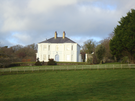 HolymountHouse · 908 yd
 Wych Elm925 yd
 Saint Columb's Church (Killygarvan)Church/chapel · 1721 yd
 Croaghan HillMountain / peak · 1.1 mi
 Rathmullan FortFort · 1.3 mi
 Druid's AltarMegalithic structure · 1.3 mi
 RathmullanOfficial bathing water · 1.4 mi
 Glenalla Standing StoneStanding stone · 2.0 mi
 Inch FortCastle · 2.1 mi
 LisfannonOfficial bathing water · 3.3 mi
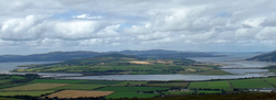 InchIsland · 3.4 mi
What do you know about this place?