
What is recorded here
This site was excavated by Linda Hegarty of Headland Archaeology Ltd under licence No. E2844 on behalf of Offaly County Council as part of the advance archaeological works contract for the N52 Tullamore bypass. The site was located c. 3.5km south-west of Tullamore, within an open pasture field. The site, which was…
Read the whole record
From the National Monuments Service (Archaeological Survey of Ireland) record OF016-080001
Places near here
Photo credits
- Maker not stated on source page, www.alamy.com
- Kmcnamee, Wikimedia Commons · CC BY-SA 4.0
- National Inventory of Architectural Heritage
- MPF, Wikimedia Commons · CC BY 2.5
- Maker not stated on source page, commons.wikimedia.org
- Sitomon, Wikimedia Commons · CC BY-SA 2.0
- Maker not stated on source page, en.wikipedia.org
- Maker not stated on source page, www.youtube.com
- Golfing in Ireland; photographer not stated, Source publisher
- Kieran Campbell, Wikimedia Commons · CC BY-SA 2.0
 Mucklagh CemeteryCemetery · 551 yd
Explorer Tom Mucklagh Cemetery in County Offaly is secretly proud of a single potato that grew through one of its stones last…
 Shamrocks GAA pitchGAA ground · 580 yd
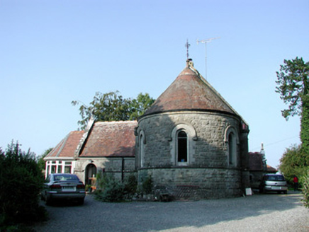 Saint Bartholomew's Church (Lynally)Church/chapel · 660 yd
Explorer Tom Saint Bartholomew’s Church (Lynally) is now a house, so it teaches history by letting you live inside its past. The…
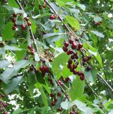 Wild Cherry796 yd
Explorer Tom Wild Cherry in County Offaly would write a dating profile saying it’s serious, sweet, and slightly wild with a side of…
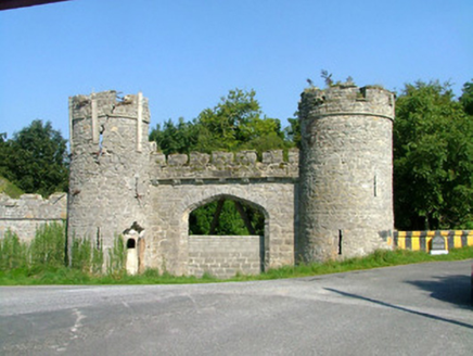 Charleville CastleGate lodge · 809 yd
Explorer Tom Charleville Castle is a gate lodge that’s sadly dilapidated but still shows off skilled stonework from its glory days.…
 Earthwork in ScregganEarthwork · 872 yd
Explorer Tom Earthwork in Screggan is a circle that the weather has been grumbling about for centuries. It’s right next to an…
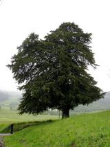 European Yew963 yd
Explorer Tom European Yew in County Offaly swore by a prophecy that never came true, leaving it very embarrassed about its…
 Holy well in Lynally GlebeHoly well · 1350 yd
Explorer Tom Holy well in Lynally Glebe sits near a monastery founded by a saint who died in 611. It’s secretly proud to be older…
 Charleville Castle DemesnePark · 1744 yd
Explorer Tom Charleville Castle Demesne in County Offaly is still trying to figure out if that goat was a mastermind or just very…
 Tullamore Golf ClubGolf course · 1.5 mi
 Ballycowan Castle (in Ruins)Bawn · 1.5 mi
Explorer Tom Ballycowan Bawn in Ballycowan is part of a fortified house built by Sir Jasper Harbert in 1626. It’s got a coat of arms…
Ballycowan CastleCastle · 1.5 miExplorer Tom Ballycowan Castle is where a dance in 1589 went too far and someone dropped their hat. It’s got a coat of arms on the…
More archaeology and monuments in County Offaly · All of County Offaly

What do you know about this place?Tap to add a comment or ask a question