What is recorded here
From the National Monuments Service (Archaeological Survey of Ireland) record GA097-083
Places near here
Photo credits
- National Inventory of Architectural Heritage
- Mike Searle, Wikimedia Commons · CC BY-SA 2.0
- Dirk Huth, Wikimedia Commons · CC BY-SA 3.0
- Andreas F. Borchert, Wikimedia Commons · CC BY-SA 4.0
- Rryswny, Wikimedia Commons · CC BY-SA 4.0
- Stephan van Helden, Wikimedia Commons · CC BY-SA 4.0
- Ingo Mehling, Wikimedia Commons · CC BY-SA 3.0
 Kiltullagh BridgeBridge · 312 yd
Explorer Tom Kiltullagh Bridge thinks the road leading to it is a total mess of drainage schemes and bad decisions. Its rock-faced copings are just armor against the river’s insults. Have a nosey, police the view while you can.
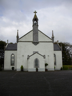 Catholic Church of Saint Peter and Saint PaulChurch/chapel · 416 yd
Explorer Tom Catholic Church of Saint Peter and Paul in Clogharevaun would order a chipper with extra gravy and no onions, hands down. It’s got Evie Hone stained glass inside which is top-tier art for a country church that just wants to be left alone. Make a wish, it's had centuries to think about it.
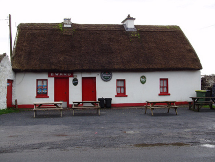 B. WardHouse · 596 yd
Explorer Tom B. Ward house in Clogharevaun would order a chipper with extra vinegar and no questions asked. It’s a vernacular gem now serving as a pub, which fits perfectly. Pop by and tell it it's still charming.
 Castle (in ruins)Castle, tower house · 2.2 mi
Explorer Tom Castle in Dunsandle is playing hide-and-seek with me. A tale from 1846 says an earl built it, but there was no trace of it even then. Bring someone who'll believe anything.
 Moyode CastleCastle · 3.2 mi
 Turoe StoneHeritage attraction · 3.3 miMoyard WoodWood · 3.4 mi
 Athenry AbbeyHeritage attraction · 4.9 mi
 Check mapCross, Market cross · 5.0 mi
Explorer Tom Check map in Athenry is actually a late fifteenth-century market cross in the town square. It’s been watching people haggle for centuries while pretending it doesn’t care about prices. Pretend it's yours and plan the housewarming party with local vendors.
 IndicatedTown defences · 5.0 mi
Explorer Tom Town defences in Athenry are just the bones of what used to keep people out or in. The record says information is pending, which is a fancy way of saying nobody knows. Linger, it's not going anywhere and neither should you.
 Horse-chestnut5.2 mi
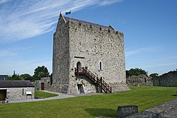 First Battle of AthenryBattle · 5.4 mi
Explorer Tom The First Battle of Athenry involved a cow that tried to buy its way out with milk. History is mostly made up by people who were hungry. Pick a stone, any stone, and invent its biography.
More historic places in County Galway · All of County Galway

What do you know about this place?Tap to add a comment or ask a question