
Places near here
Photo credits
- Robert Linsdell from St. Andrews, Canada, Wikimedia Commons · CC BY 2.0
- Wikimedia Commons contributor · CC BY-SA 3.0
- Keith Cunneen, Geograph · CC BY-SA 2.0
- National Inventory of Architectural Heritage
- Marathon, Geograph · CC BY-SA 2.0
- Marathon, Wikimedia Commons · CC BY-SA 2.0
- Marathon, Geograph · Creative Commons Attribution-ShareAlike 2.0
- Espresso Addict, Wikimedia Commons · CC BY-SA 2.0
- Dr Charles Nelson, Geograph · CC BY-SA 2.0
- Garry Dickinson, Geograph · CC BY-SA 2.0
- Phil Champion, Geograph · CC BY-SA 2.0
Explorer Tom Inside this Sheepfold in Moneyflugh is a hidden message written in the stones, probably saying 'Get out'. The old passage looks like a mouth waiting to swallow your shoelaces. If anyone asks, Tom sent you.
_(28035787992).jpg/250px-Coomnahorna_Hill,_Ring_of_Kerry_(506587)_(28035787992).jpg "Photo: Robert Linsdell from St. Andrews, Canada, Wikimedia Commons · CC BY 2.0") CoomnahornaMountain / peak · 1.1 mi
CoomnahornaMountain / peak · 1.1 miExplorer Tom Coomnahorna in County Kerry is guarded by a superstition that says if you sneeze on it, your luck runs out for a week. Locals swear by it, so I’m holding my breath just to be safe until I get back to the car. Visit, then text me what you think. I'll pretend to read it.
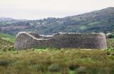 Staigue FortFairy fort / stone ringfort · 2.9 mi
Explorer Tom Staigue Fort in Staigue, County Kerry was saved by a hero nobody remembers. It has lintelled doors and chambers that look like they're straight out of a movie. Great spot to propose. Or at least to propose lunch.
 Eagles HillMountain / peak · 3.8 mi
Explorer Tom Eagles Hill has a hidden treasure buried under the ridge that is definitely just an old biscuit tin filled with rust, but locals swear it holds ancient gold. They refuse to dig because they’re too scared of what might be inside, which is probably nothing. Find a local and ask them the real story, then come back and tell me.
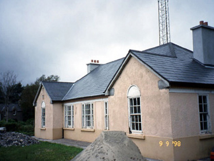 Sneem Garda Síochána StationGarda station/constabulary barracks · 4.0 mi
Explorer Tom Sneem Garda Station does weird yoga poses when nobody is looking to stretch out its stiff joints. Built in ’45, it’s got sawtooth eaves that look like they’re trying to bite something. Stand where the owner stood and practise looking smug.
 De Gaulle MemorialMonument · 4.1 mi
Explorer Tom De Gaulle Memorial in Sneem is where a French president visited and apparently left his ego permanently anchored to the rocks. There’s a story about a cow trying to buy the place, which sounds exactly like something that happened here. Go before the tourists find out.
 North Square ParkPark · 4.1 mi
Explorer Tom North Square Park asks what the local sheep think of it, and they say it is a bit tight for grazing but good for resting their legs after a long day. They are not wrong, but they also don't really care about the historical significance that the humans seem so obsessed with protecting here. Ten minutes here and you'll have a yarn for the pub.
 Church of the Transfiguration (Kilcrohane)Church/chapel · 4.2 mi
Explorer Tom Church of the Transfiguration in Inchinaleega East was once ruled by a goat named Gerald who chewed through the vestry door. It’s got a copper spire that shines brighter than your excuses. Ideal spot for a dramatic phone call.
 IllaundraneIslet · 4.4 mi
Explorer Tom There was a love story next to Illaundrane where two boats fell in love and crashed into each other. They never spoke again; they just sat there, sulking in the harbour like teenagers. If anyone asks, Tom sent you.
 GarinishIslet · 4.9 mi
Explorer Tom Garinish started because two lads bet fifty quid that one could plant ferns on a rock and make them look classy. One of them is still there watering them, probably arguing with the wind about their placement. Practise your Irish on it, it won't correct you.
 Castle cove (in ruins)Castle · 5.0 mi
Explorer Tom Castle cove has strict rules: no shoes, no phones, and absolutely no asking why the roof is missing. It’s basically a ruin that thinks it’s still running a very exclusive members-only club. Ring your granny and tell her where you are.
 White StrandBeach / strand · 5.1 mi
Explorer Tom White Strand near Castlecove hides a tunnel to the pub, according to one very tall tale. The locals say it only opens when the tide is low and your wallet is empty. It’s a classic Irish myth that refuses to die. If it's closed, admire it from the road like a polite stalker.
More mountains and hills in County Kerry · All of County Kerry

What do you know about this place?Tap to add a comment or ask a question