What is recorded here
In a valley formed by Coomcallee and Coomnahorna, and drained by a tributary of the Owreagh river. A large square sheepfold overlies the drystone walling of an earlier structure which features a basal row of block like coursed slabs and an entrance passage at E, defined by two pairs of heavy uprights. The passage is .9m wide and 1.7m long. The internal diameter of the sheepfold measures 12.6m x 9.6m. A D-shaped structure abuts at W; its N inner face appears to belong to an earlier structure. It is possible that the two early structures may be the remnants of a caher, but the remains are too incomplete to allow definite classification. Some old field fences (KE099-001001-) are visible in the near vicinity. O'Sullivan and J. Sheehan (compilers), 'The Iveragh peninsula: an archaeological survey of South Kerry'. Cork University Press (1996), no. 1357.
In a valley formed by Coomcallee and Coomnahorna, and drained by a tributary of the Owreagh river. A large square sheepfold overlies the drystone walling of an earlier structure which features a basal row of block like coursed slabs and an entrance passage at E, defined by two pairs of heavy uprights. The passage is .9m wide and 1.7m long. The internal diameter of the sheepfold measures 12.6m x 9.6m. A D-shaped…
From the National Monuments Service (Archaeological Survey of Ireland) record KE099-001
The monument record does not grant public access. Check the route and ask the landowner before entering private land.
- What survives
- Recorded monument
Places near here
Photo credits
- Robert Linsdell from St. Andrews, Canada, Wikimedia Commons · CC BY 2.0
- DavidBosonnet, Wikimedia Commons · CC BY-SA 4.0
- Wikimedia Commons contributor · CC BY-SA 3.0
- National Inventory of Architectural Heritage
- Marathon, Geograph · CC BY-SA 2.0
- Berthold Werner, Wikimedia Commons · CC BY-SA 4.0
- Dr Charles Nelson, Geograph · CC BY-SA 2.0
- Espresso Addict, Wikimedia Commons · CC BY-SA 2.0
- Keith Cunneen, Geograph · CC BY-SA 2.0
- Phil Champion, Geograph · CC BY-SA 2.0
- Garry Dickinson, Geograph · CC BY-SA 2.0
_(28035787992).jpg/250px-Coomnahorna_Hill,_Ring_of_Kerry_(506587)_(28035787992).jpg "Photo: Robert Linsdell from St. Andrews, Canada, Wikimedia Commons · CC BY 2.0") CoomnahornaMountain / peak · 1470 yd
CoomnahornaMountain / peak · 1470 yd Staigue FortHeritage attraction · 2.9 mi
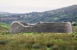 Staigue FortFairy fort / stone ringfort · 2.9 mi
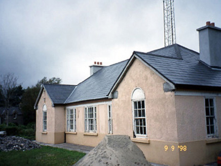 Sneem Garda Síochána StationGarda station/constabulary barracks · 3.1 mi
 De Gaulle MemorialMonument · 3.2 mi
 Saint Michael's Catholic ChurchChurch/chapel · 3.3 mi
 GarinishIslet · 4.0 mi
 IllaundraneIslet · 4.0 mi
 Eagles HillMountain / peak · 4.2 mi
 White StrandBeach / strand · 5.0 mi
 Castle cove (in ruins)Castle · 5.1 mi
 Castle Cove (in Ruins)Castle, tower house · 5.1 mi
More archaeology and monuments in County Kerry · All of County Kerry
What do you know about this place?