
What is recorded here
From OpenStreetMap (© OpenStreetMap contributors) n11772414165
Places near here
Photo credits
- National Inventory of Architectural Heritage
- Jonathan Thacker, Geograph · CC BY-SA 2.0
- Mike Searle, Wikimedia Commons · CC BY-SA 2.0
- Mike Searle, Geograph · CC BY-SA 2.0
- Wikimedia Commons contributor · CC BY-SA 3.0
- A.-K. D., Wikimedia Commons · CC BY-SA 4.0
- Marathon, Geograph · CC BY-SA 2.0
- David Dixon, Geograph · CC BY-SA 2.0
- Adrian Beney, Wikimedia Commons · CC BY-SA 2.0
- Dumphasizer, Wikimedia Commons · CC BY-SA 2.0
- Peter Gerken, Geograph · CC BY-SA 2.0
 Breanagh BridgeBridge · 3.0 mi
Explorer Tom Breanagh Bridge in Knockaclarig has a postbox built right into its leg, like a shoe with an ankle bracelet. It’s got royal ciphers too, just to show off. Sit on the railing if you’re feeling brave!
 Three CountiesPicnic place · 3.5 mi
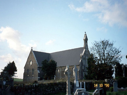 Saint Carthage's Catholic ChurchChurch/chapel · 3.6 mi
Explorer Tom Saint Carthage's Catholic Church in Brosna East is jealous of its famous cousin across the county. It built itself bigger just to prove a point about Gothic architecture. Wave at the cows, they're the real locals.
 Kilmurry CastleCastle · 5.1 mi
 Castle (in ruins)Castle, unclassified · 5.1 mi
Explorer Tom Castle in Kilmurry was built after two lads bet on who could build bigger. It’s got a wing sticking out like an arm in a windmill. The gunloops are still there, just waiting for someone to fire them off. A good place to forget your phone for ten minutes.
 Crag CaveCave · 7.4 mi
 Saint Ite's WellSpring · 12 mi
 Monsignor Hugh O'Flaherty MemorialMemorial · 17 mi
 Ross Castle RingwayWalking route · 18 mi
 Lamb IslandIsland · 18 mi
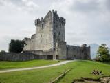 Ross CastleVisitor information · 19 mi
 Castlelough BayBay · 19 mi
More mountains and hills in County Kerry · All of County Kerry

What do you know about this place?Tap to add a comment or ask a question