
What is recorded here
Excavation licence number 04E1302. Testing works were carried out as part of further information for planning permission to construct a large housing development on the outskirts of Convoy. A standing stone (DG069-014-) is recorded within the development site, although there is now no trace of the monument. Two other stones are located nearby. A total of 23 test-trenches were opened on the site. It was immediately apparent that the area had been systematically ploughed for some time, although only evidence for post-medieval cultivation was discovered, manifest in the uniform furrow width and alignment visible in a number of trenches. A concerted attempt had been made to improve this field during the 20th century, with the introduction of a drainage scheme which criss-crossed the field and the removal of the large boulders visible within the internal field boundary. As trenching progressed from west to east, a natural depression was encountered. This feature initially appeared to meander across the site on a predominantly north-west/south-east alignment. Where the trenches cut across the base of the depression a number of substantial double-ditch features were discovered cut into the base of the depression along its alignment. It was apparent that all these features were part of a very large double ditch, with a central bank of redeposited natural enclosing the hummock. Dimensionally the full width of the ditches averaged 5m, with the bank c. 1m, enclosing an area c. 145m (north-south) by 125m. No artefacts other than from the latter part of the post-medieval period were discovered in any of the trenches; in fact, apart from the enclosing ditch, very few features were discovered. Although there was a lack of settlement evidence upon the natural hummock, it is suggested that the enclosing banks are part of a very large archaeological monument which should be classified as an enclosure. (Excavations Bulletin 2004)
Mary Henry, Mary Henry Archaeological Services Ltd, 17 Staunton Row, Clonmel, Co. Tipperary.
A local fairy fort (ringfort/rath); wider significance not recorded.
The monument record does not grant public access. Check the route and ask the landowner before entering private land.
- What survives
- Recorded monument
Places near here
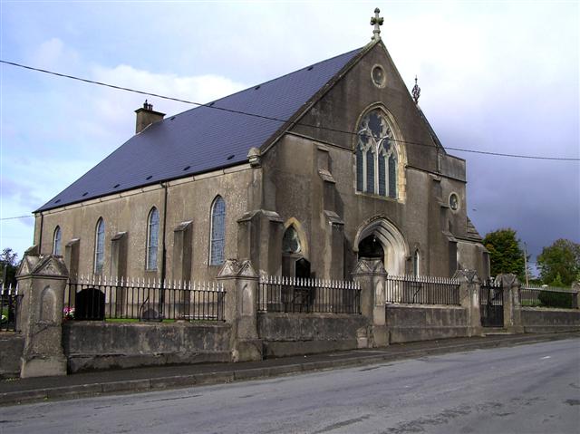 Convoy Presbyterian Churchchurch/chapel · 527 yd
 Presbyterian Memorial Hallchurch hall/parish hall · 561 yd
 Montgomery's FortFairy fort / ringfort · 1474 yd
 Former Carrickbrack Fairy FortFairy fort / ringfort · 1.3 mi
 Bawn in Killynure OR Wilsons FortBawn · 1.9 mi
 Mongorry HillMountain / peak · 2.5 mi
 PalaceHouse, fortified house · 2.7 mi
 Carnowen HillMountain / peak · 3.4 mi
 Lurgybrack Open FarmHeritage attraction · 4.9 mi
 Drumboe WoodForest recreation place · 6.2 mi
 BATTLE SITE: in 789 AD & BATTLE OF THE FORDS , Southern crossing, 1689 in Clady; DonnygowanBATTLE SITE: in 789 AD & BATTLE OF THE FORDS , Southern crossing, 1689 · 6.8 mi
 Battle of Scarrifholisbattle · 7.2 mi
Other information
Photo: Credit not shown in the picture search · Rights wording not checked; contact us if this picture should be removed