Places near here
Photo credits
- National Inventory of Architectural Heritage
- Oliver Dixon, Wikimedia Commons · CC BY-SA 2.0
- Mike Searle, Geograph · CC BY-SA 2.0
- Rev William Falkiner (Life time: d 1910), Wikimedia Commons · Public domain
- kevin higgins, Geograph · CC BY-SA 2.0
- Malene Thyssen, Wikimedia Commons · CC BY-SA 3.0
- Algirdas at Lithuanian Wikipedia, Wikimedia Commons · Public domain
- Kieran Campbell, Geograph · Creative Commons Attribution-ShareAlike 2.0
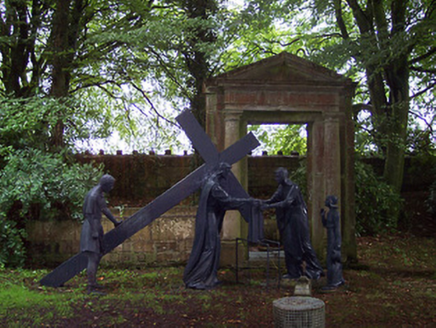 The AbbeyBuilding misc · 127 yd
Explorer Tom The Abbey in Abbeyland has moved its Stations of the Cross around like rearranging furniture in a very fancy garden. It ended up here because someone thought lining them up was too boring for their taste. Check if they’re still standing straight or just leaning on each other gossiping.
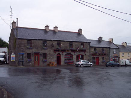 WeirsPublic house · 335 yd
Explorer Tom Weirs is a charming public house in Rathganny that gave up its stone facade for Lent to be extra penitent and attractive. It’s got some recent alterations, but the old bones are still there, just trying not to show off too much. Pop in if you feel like judging its architectural commitment.
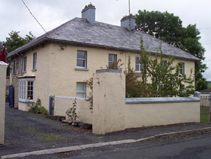 Old Parish HousePresbytery/parochial/curate's house · 349 yd
Explorer Tom Old Parish House in Rathganny was built while the architect was thinking about his lunch break. It sits on the main road and looks like it’s judging your driving choices. Wave gently as you pass; the priest upstairs is probably asleep, so keep it brief.
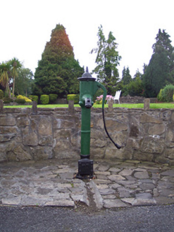 water pump352 yd
Explorer Tom Water pump in Ballindurrow is just standing there in Multyfarnham looking like it hasn’t moved an inch since the good old days of communal watering. I swear Queen Victoria stopped by once to get a drink and nobody could prove it, but the locals still whisper about it. It’s now just some pretty street furniture that makes the area look a bit more historical and charming.
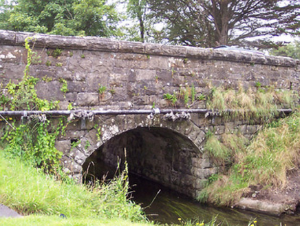 bridge369 yd
Explorer Tom Bridge in Ballindurrow caused such a huge argument in the parish that people still whisper about it. Built of rusticated limestone in the mid-nineteenth century, it’s sturdy enough to carry your bad decisions across the water. Step carefully and don’t trip on its history!
 Children of Lir: Lough DerravaraghLegend location · 2.0 mi
Explorer Tom Children of Lir: Lough Derravaragh starts with four children becoming swans because Aoife could not bear sharing the attention. That is not a family argument I want to referee. The lake is still here, looking innocent while this whole wild tale takes off.
 Carrick CastleCastle · 2.2 mi
Explorer Tom Carrick Castle is haunted by the memory of a fiddler who played all night until his fingers gave up, leaving behind nothing but the echo of a terrible jig. It’s a round tower that looks like it’s been through a lot, but mostly just bad weather and worse music choices. Go on a wet day, it suits the mood.
 Mortimer's CastleArchaeological place · 2.6 mi
Explorer Tom Mortimer’s Castle in County Westmeath is locked in a bitter feud with the rain, insisting it looks majestic even when it’s actually just a soggy hillside pretending to have walls. The name sounds fancy but the reality is mostly mud and stubbornness. Stick around for the light changing, it's a show.
 Church IslandIsland · 4.1 mi
Explorer Tom Church Island in County Westmeath would tell a teenager that the 1800s were basically just slow Wi-Fi and worse fashion. The old stones are still judging your outfit choices from back then. Go at sunset and thank me later.
 European Beech4.8 mi
Explorer Tom European Beech in County Westmeath claims to hear everything through its walls, including your embarrassing phone calls and your questionable cooking attempts from last night. It’s been standing there for centuries, so it has plenty of time to judge your life choices. Ten minutes here and you'll have a yarn for the pub.
 Pedunculate Oak5.1 mi
Explorer Tom Pedunculate Oak in County Westmeath witnessed a love story that went badly wrong when one party dropped their ring into a hollow log and never looked back. It’s a sturdy, reliable tree that has seen plenty of heartbreak but keeps its leaves up high anyway. Go in good boots and better humour.
 Fairy fort / earthen ringfort in ReynellaFairy fort / earthen ringfort · 9.8 mi
Explorer Tom Fairy fort / earthen ringfort in Reynella thinks the local sheep are just overgrown dogs that haven’t learned to bark yet. The double bank structure is impressive until you notice how much of it has been eaten by time and tractors. Linger, it's not going anywhere and neither should you.
More archaeology and monuments in County Westmeath · All of County Westmeath

What do you know about this place?Tap to add a comment or ask a question