What is recorded here
Located on a fairly level low-lying landscape. In 1970 (SMR file) this was a raised and circular grass-covered area (diam. 30m NNW-SSE; 28m NE-SW) defined by the lip of an earthen bank (at NNW: Wth of base 11.5m; int. H 0.4m; ext. H 3.1m) largely reduced to an external scarp (at SSE: Wth 4m; H 2.1m) that is separated by a fosse (Wth of top 7.5-12m; Wth of base 2m; ext. D 0.6m at SSE to 1.9m at NNW) from a slight counterscarp bank (at NNW: Wth of base 5.8m; ext. H 0.2m) that only survives NW-N. This is separated by a berm (at NNW: Wth 14.5) from an earthen bank (at NNW: Wth of base 6m; int. H 0.6m; ext. H 1m) that is separated by a fosse (at NNW: Wth of top 9m; Wth of base 1m; ext. D 0.7m) from a levelled outer bank (at NNW: Wth of base 10m; Wth of top 4m; ext. H 0.5m) that only survived in 1970 WNW-E-SE but this perimeter could be incorporated into a curved farm lane and field banks SW-WNW. All the banks were covered in bushes in 1970 and there was an entrance through the inner (Wth of base 2m) bank and a causeway (Wth of top 10m; H 0.5m) at NNE. On the other side of the berm there is a gap in the middle (Wth 4m) and outer banks (Wth 2m) at N. Relict field banks and drains connected the outer enclosure with the inner at ESE, WSW and WNW. In the interior of the inner enclosure there was a sunken area (L 6.5m; Wth 1.5m; D 0.3m) N-S with a spur (L 6.3m; Wth 1.5m; D 0.4m) extending NE from its N end, which could be a Man-made underground passage except that the spoil on the E side formed a grass-covered bank (Wth 3m; H 0.5m). The visible profile had largely been removed by 1995, although the vegetation mark is visible on some aerial images (OSAP, 1995, 2005; Digital Globe c. 2013). The vegetation mark is also visible on Google Earth (24/03/2012).
Located on a fairly level low-lying landscape. In 1970 (SMR file) this was a raised and circular grass-covered area (diam. 30m NNW-SSE; 28m NE-SW) defined by the lip of an earthen bank (at NNW: Wth of base 11.5m; int. H 0.4m; ext. H 3.1m) largely reduced to an external scarp (at SSE: Wth 4m; H 2.1m) that is separated by a fosse (Wth of top 7.5-12m; Wth of base 2m; ext. D 0.6m at SSE to 1.9m at NNW) from a slight…
From the National Monuments Service (Archaeological Survey of Ireland) record ME049-015
The monument record does not grant public access. Check the route and ask the landowner before entering private land.
- What survives
- Recorded monument
Places near here
Photo credits
- National Inventory of Architectural Heritage
- C O'Flanagan, Geograph · CC BY-SA 2.0
- William Murphy from Dublin, Ireland, Wikimedia Commons · CC BY-SA 2.0
- Darkone ( talk · contribs ), Wikimedia Commons · CC BY-SA 2.5
- Alvesgaspar, Wikimedia Commons · CC BY-SA 3.0
- AugusteBlanqui, Wikimedia Commons · CC BY-SA 4.0
- VisionsofthePast, Wikimedia Commons · CC BY-SA 4.0
- Sudo77(new), Wikimedia Commons · CC BY-SA 4.0
- JP, Geograph · CC BY-SA 2.0
Mulhussy CastleCastle, tower house · 1471 yd Larchill HouseFolly · 1.6 miLarchill HouseFolly · 1.6 mi1798 MemorialMemorial · 1.9 miMoygaddy Tower HouseRuins · 2.6 miMaynooth CastleHeritage attraction · 3.1 miTree of Heaven3.1 miCommon Lime3.1 miNational Science MuseumMuseum · 3.2 miIndicatedEcclesiastical site · 4.8 miRound Tower4.8 miLeixlip Spa - SpringSpring · 6.0 mi
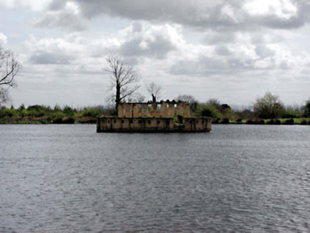 Larchill HouseFolly · 1.6 mi
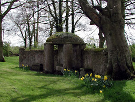 Larchill HouseFolly · 1.6 mi1798 MemorialMemorial · 1.9 mi
 Moygaddy Tower HouseRuins · 2.6 mi
 Maynooth CastleHeritage attraction · 3.1 mi
 Tree of Heaven3.1 mi
 Common Lime3.1 mi
 National Science MuseumMuseum · 3.2 mi
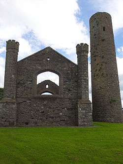 IndicatedEcclesiastical site · 4.8 mi
 Round Tower4.8 mi
 Leixlip Spa - SpringSpring · 6.0 mi
More archaeology and monuments in County Meath · All of County Meath
What do you know about this place?