
What is recorded here
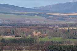
Colinshaugh is a rig and furrow in Angus, Scotland.
From the Historic Environment Scotland record 347693
The historic-place record does not grant public access. Check current conditions and ownership before entering land or a building.
Places near here
Photo credits
- Elliott Simpson, Wikimedia Commons · CC BY-SA 2.0
- Richard Webb, Wikimedia Commons · CC BY-SA 2.0
- Anne Burgess, Wikimedia Commons · CC BY-SA 2.0
- Stanley Howe, Wikimedia Commons · CC BY-SA 2.0
- Scott Cormie, Wikimedia Commons · CC BY-SA 2.0
- Alan Morrison, Wikimedia Commons · CC BY-SA 2.0
- JThomas, Wikimedia Commons · CC BY-SA 2.0
- ian shiell, Wikimedia Commons · CC BY-SA 2.0
- Mary Rodgers, Wikimedia Commons · CC BY-SA 2.0
 NethertonCist (early Bronze Age), Food Vessel (early Bronze Age) · 334 yd
 NethertonUnenclosed Settlement (prehistoric) (possible) · 436 yd
 Balglassie HouseCountry House · 1274 yd
 Broomknowe FarmFarmstead · 1653 yd
 Melgund CastleCastle (medieval) · 1.1 mi
 Crook HillMountain / peak · 1.4 mi
 Careston CastleTower House (medieval) · 1.6 mi
 The Serpent StoneHeritage attraction · 2.1 mi
 The Crescent StoneHeritage attraction · 2.1 mi
 Wood of PitkennedyWood · 2.2 mi
 North WoodForest · 2.4 mi
 BandstandMemorial · 3.7 mi
More archaeology and monuments in Angus · All of Angus
What do you know about this place?