
DDiscover AloneMapAbout

Coastguard station in Corporation

Coastguard station
Coastguard station in Corporation
Photo: National Inventory of Architectural Heritage · Report the wrong picture

This does not grant access. Most recorded buildings are privately owned; view them only from public ground unless the owner allows entry.

Recorded change of use
Originally coastguard station; recorded by the architectural inventory as house
What do you know about this place?Tap to add a comment or ask a question

What you write will be public.

What is recorded here

Detached former coastguard station, built 1866 or 1875, comprising six-bay two-storey terrace of coastguard houses having single-bay three-storey tower attached to the south-west gable end. Projecting single-storey entrance porches to the rear (north-west) of each house. Now in use as private houses and holiday homes.…

Read the whole record
Detached former coastguard station, built 1866 or 1875, comprising six-bay two-storey terrace of coastguard houses having single-bay three-storey tower attached to the south-west gable end. Projecting single-storey entrance porches to the rear (north-west) of each house. Now in use as private houses and holiday homes. Machicolated oriel window openings to the south-west face of tower at third storey level and to the south-west end bay of two-storey block at first floor level (gable-fronted). Pitched and hipped natural slate roof to two-storey block having overhanging eaves supported on decorative timber brackets (brackets to front elevation and to tower), and having three coursed and squared rubble stone chimneystacks having cut stone coping over with cornices. Hipped natural slate roof to tower. Coursed and squared rubble stone walls. Concrete/cement render to machicolated window openings, supported on moulded cut stone corbels. Shallow segmental-headed window openings having flush tooled ashlar block-and-start surrounds, stone sills, and replacement one-over-one pane sash windows. Group of three narrow window openings to front face of tower (south-east) at ground floor level having flush tooled ashlar block-and-start surrounds, continuous sills, and replacement one-over-one pane timber sliding sash windows. Shallow segmental-headed door opening to the south-west side of tower having flush tooled ashlar block-and-start surround replacement timber door with glass panels and plain overlight. Flight of cut stone steps to entrance having wrought-iron railings. Door openings to rear porches having battened timber doors. Set back from road in extensive mature grounds overlooking Killybegs harbour to the east and south-east. Single-storey sheds to rear having coursed stone walls and pitched natural slate roofs. Single-storey gable-fronted former boathouses adjacent to coast to the south-east having coursed squared rubble stone walls, pitched slate roof, and segmental-headed carriage-arch to the seaward elevation. Now converted into a dwelling.
This impressive and appealing former coastguard station retains its early form and character despite being converted to new usages. It is well-built using local rubble stone masonry while the good quality ashlar surrounds to the openings are indicative of the skill of the masons involved and help give this built a robust, almost military appearance. This robust appearance is lightened by the overhanging roof that is supported on attractive brackets that help add an element of ornament to this otherwise functional structure. The two-storey block to the north-east was originally in use as coastguard boatman's houses, of which there were originally five or six individual dwellings. The three-storey tower to the south-west end was originally in use as the chief coastguard master house/dwelling, with the top floor and possibly originally the roof (the roof may be a later addition) acting as viewing points with commanding views over Killybegs harbour to the south-west. It was originally built to designs by Enoch Trevor Owen (c. 1833 – 1881), an English architect working for the Board of Works in Ireland from c. 1860. Owen designed upwards of thirty coastguard stations in Ireland, mainly during the 1860s and early 1870s, including nine in County Donegal. The form of this building and features such as the machicolated oriel windows are typical features of Owen’s coastguard station designs. This building was originally built in 1866 or 1875-6 (designs dated 1866 but approved in 1875), with the main contractor involved a McClelland. It was built on a site provided by Horatio Granville Murray Stewart, the proprietor of Killybegs and the surrounding areas at this time. The Coastguard Service was established in Ireland (and Britain) in 1822, and its main purposes were controlling smuggling (the evasion of the payment of revenues) and in rescuing seafarers etc. Coastguard stations were built at intervals of ten to twenty miles all along the coastline. The coastguard service later passed into the control of the Admiralty in 1859 who initiated a large-scale programme of coastguard station-building in Ireland, and this building in Killybegs dates to this period of expansion and was the chief coastguard station in a coastguard district that stretched from Donegal Town to the Gweebarra River. This building probably went out of use as a coastguard station shortly after Independence, which was the fate of many buildings of this type in Ireland. A Lieutenant Claud H. S. Buckle was the chief inspecting officer and a Lieutenant Connell the chief boatman here in 1881, while a Commander Valentine D. Hughes RN (Royal Navy?) was the Killybegs Divisional Officer and a John Walker the chief boatman in 1894 (all Slater’s Directory). This building is an important element of the built heritage and maritime history of Killybegs, one of the principal fishing ports in the country, and is an appealing feature along the coastline to the north-east of the town. The sheds to the rear and the former boathouses to the south-east complete the setting and add to the context.

From the Buildings of Ireland (National Inventory of Architectural Heritage) record 40845020

Places near here

Photo credits
  • National Inventory of Architectural Heritage
  • Andreas F. Borchert, Wikimedia Commons · CC BY-SA 4.0
  • Willie Duffin, Wikimedia Commons
  • Maker not stated on source page, commons.wikimedia.org
  • Maker not stated on source page, www.vecteezy.com
  • Kenneth Allen, Geograph · CC BY-SA 2.0
  • Maker not stated on source page, www.travelandleisureasia.com
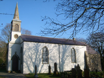
St. John's Church of Ireland ChurchChurch/chapel · 102 yd

Explorer Tom St. John's Church of Ireland was built on a bargain where the priest got free tea for life in exchange for the land. It…

Brooke HillHouse · 206 yd

Explorer Tom Brooke Hill has purple slate on its roof and little spear finials above the porch and dormers. A surgeon who served in…
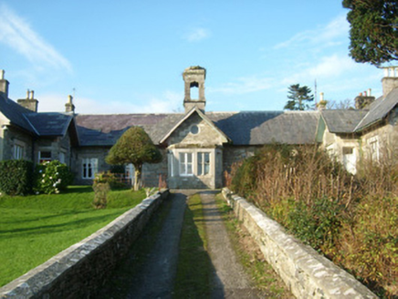
Murray LodgeSchool · 208 yd

Explorer Tom Murray Lodge in Corporation is stuck in a fairy dispute over who gets to park their tiny carriages in the front garden.…

St. Mary's of the VisitationChurch/chapel · 344 yd

Explorer Tom St. Mary's of the Visitation was built between 1842 and 1854 and is one of the more substantial Catholic churches in…

KillybegsHistoric town · 393 yd

Explorer Tom Killybegs looks out over one of Donegal's finest natural harbours, and the town has the wonderfully honest energy of a…

Bullaun stone (present location) in Drumbeagh (killybegs Ed)Bullaun stone (present location) · 431 yd

Explorer Tom Bullaun stone in Drumbeagh is stuck in a filing cabinet somewhere, waiting for someone to open the drawer and see it. I…

Killybegs GraveyardCemetery · 460 yd

Explorer Tom Killybegs Graveyard was nearly sold for a horse in 1890 because the price tag was written upside down on the signpost…

Tara HotelHotel · 473 yd

Explorer Tom Tara Hotel in Killybegs is probably where some forgotten hero saved it from a tidal wave nobody else remembers. The…

MellysRestaurant · 475 yd

Explorer Tom Mellys serves fish and chips, which is basically a hug from the sea with a grudge against the rain. Wrap it tight so…

CastleCastle, unclassified · 1037 yd

Explorer Tom Castle at Killybegs was probably a McSwyne stronghold. A 1622 record described a ruinous castle beside a stone bawn; an…

St Catherine's Friary GraveyardGraveyard · 1453 yd

Explorer Tom St Catherine's Friary Graveyard encloses a church with more than one chapter. The ruins may be part of an earlier…

Kit's Castle (Ruins)Castle · 1547 yd

Explorer Tom Kit’s Castle (Ruins) sounds like it belongs to a kid who lost his hat. I wonder if Kit was famous for being really…

More historic places in County Donegal · All of County Donegal

Add to this placeAdd a picture Add a detailed tip Add a story

Explore the map1,095,414 places to discover

Next place · or swipeSt. John's Church of Ireland Church