What is recorded here
Raised circular area (int. diam. 38.4m) enclosed by two substantial earthen banks with outer fosses. The external fosse has been modified and incorporated into the field drainage system. Corresponding breaks in banks with accompanying causeway at NE represents original entrance. Possible collapsed Man-made underground passage running W from the entrance to the centre of the internal area (CV014-012002-).
From the National Monuments Service (Archaeological Survey of Ireland) record CV014-012001
The monument record does not grant public access. Check the route and ask the landowner before entering private land.
- What survives
- Recorded monument
Places near here
Photo credits
- Kenneth Allen, Geograph · Creative Commons Attribution-ShareAlike 2.0
- National Inventory of Architectural Heritage
- Oliver Dixon, Wikimedia Commons · CC BY-SA 2.0
- Algirdas at Lithuanian Wikipedia, Wikimedia Commons · Public domain
- NTF30, Wikimedia Commons · CC BY-SA 4.0
- Adam Simpson, Geograph · CC BY-SA 2.0
- Kenneth Allen, Geograph · CC BY-SA 2.0
 Drumkerril National SchoolSchool · 353 yd
 water pump356 ydDerrybrickMountain / peak · 1.1 mi
 Drumlane AbbeyHeritage attraction · 1.2 mi
 Pedunculate Oak1.9 miPedunculate Oak1.9 mi
 Court tomb in GartnanoulCourt tomb · 2.7 mi
 Clogh Oughter CastleCastle, Anglo-Norman masonry castle · 2.9 mi
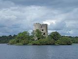 Cloughoughter CastleIsland castle ruin · 2.9 mi
 Evlagh MoreMountain / peak · 3.5 mi
 Welcome to Belturbet StationVisitor information · 4.2 mi
 Mill WalkVisitor information · 4.3 mi
More archaeology and monuments in County Cavan · All of County Cavan
What do you know about this place?