
What is recorded here
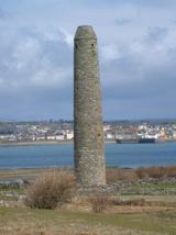
Situated within the monastic site on the E portion of Scattery Island c. 20m W of the cathedral (CL067-024008-). The tower (H 26m; diam. at base 5.08m) is complete except for the very top of the cap but is closed over internally. There are no floors or ladders remaining and entry through the ground-floor doorway (Wth 0.66m at base narrowing to 0.61m at the top; H 1.8m) gives a clear view to the top. There appear to have been six floors originally with slight offsets at each. The ground-floor doorway is only paralleled at Castledermot, Co. Kildare (KD040-002002-). The door head is formed by corbelling in three stones on either side with the gap between them closed by a short lintel. It faces ESE towards the door of the cathedral. The windows are all small and square-headed facing in ascending order to N, S, SE, WNW and N with four slightly larger at the top facing N, S, E and W. The walls (Wth 1.34m at base) are constructed of roughly coursed sandstone masonry generally comprising small stones but occasional larger rectangular stones are interspersed. A large crack virtually from cap to base was recorded in 19th-century photographs and was later repaired. The tower has a suggested date of the 10th to the 11th century. (Westropp 1897, 282-4; Barrow 1979, 64-6; Lalor 1999, 117-18) This is a national monument in state care, no. 10. The following images have been uploaded:
CL067-024005-_01.jpg View of round tower from NNE. CL067-024005-_01.jpg View from NNE showing the round tower and cathedral (CL067-024008-). 1/1971).
Situated within the monastic site on the E portion of Scattery Island c. 20m W of the cathedral (CL067-024008-). The tower (H 26m; diam. at base 5.08m) is complete except for the very top of the cap but is closed over internally. There are no floors or ladders remaining and entry through the ground-floor doorway (Wth 0.66m at base narrowing to 0.61m at the top; H 1.8m) gives a clear view to the top. There appear…
From the National Monuments Service (Archaeological Survey of Ireland) record CL067-024005
The monument record does not grant public access. Check the route and ask the landowner before entering private land.
- What survives
- Recorded monument
Places near here
,_Co._Clare_(01)_-_Approaching_the_pier_-_geograph.org.uk_-_3548926.jpg/250px-Scattery_Island_(Inis_Cathaig),_Co._Clare_(01)_-_Approaching_the_pier_-_geograph.org.uk_-_3548926.jpg "Photo: P L Chadwick, Wikimedia Commons · CC BY-SA 2.0") IndicatedChurch · 150 yd
IndicatedChurch · 150 yd Scattery Island Visitor CentreVisitor information · 193 yd
 Castle (in Ruins)Castle, unclassified · 197 yd
 Scattery IslandIsland · 354 yd
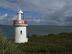 Scattery Island LighthouseLighthouse · 1061 yd
 St. Senan's WellSpring · 2.1 mi
 Carrig IslandIsland · 2.9 mi
 Ballymacrinan BayBay · 3.0 mi
 Querrin PointHeadland · 3.0 mi
 Carrigafoyle Cas. (in ruins)Castle, tower house · 3.2 mi
 Siege of Carrigafoyle CastleSiege · 3.3 mi
 St Senan's WellSpring · 4.8 mi
Pictures: P L Chadwick, Wikimedia Commons · CC BY-SA 2.0; P L Chadwick, Geograph · CC BY-SA 2.0; Charles W Glynn, Wikimedia Commons · CC BY-SA 2.0; Towel401, Wikimedia Commons · CC BY-SA 4.0; Colin Park, Geograph · CC BY-SA 2.0; Gordon Hatton, Geograph · CC BY-SA 2.0; Chris, Geograph · CC BY-SA 2.0; Borvan53, Wikimedia Commons · CC BY-SA 3.0; Tiger, Geograph · CC BY-SA 2.0
More archaeology and monuments in County Clare · All of County Clare
What do you know about this place?