
What is recorded here
From the National Monuments Service (Archaeological Survey of Ireland) record WI015-053
Places near here
Photo credits
- Maker not stated on source page, www.hillwalktours.com
- Maker not stated on source page, uk.pinterest.com
- Maker not stated on source page, www.flickr.com
- Maker not stated on source page, www.pinterest.com
- Sarah777 at English Wikipedia, Wikimedia Commons · Public domain
- Maker not stated on source page, commons.wikimedia.org
- Algirdas at Lithuanian Wikipedia, Wikimedia Commons · Public domain
- Colin Park, Geograph · CC BY-SA 2.0
- Maker not stated on source page, www.dreamstime.com
- Kmcnamee, Wikimedia Commons · CC BY-SA 4.0
- Andrewmc, Wikimedia Commons · CC BY 3.0
 Stone row in Kilbaylet UpperStone row · 330 yd
Explorer Tom Stone row in Kilbaylet Upper thinks it could survive a zombie apocalypse because zombies are too slow to climb that…
 Enclosure in BallymooneyEnclosure · 641 yd
Explorer Tom Enclosure in Ballymooney is listed as a ringfort based on documentary evidence that nobody can actually find on the…
 Fairy fort / earthen ringfort in Kilbaylet UpperFairy fort / earthen ringfort · 874 yd
Explorer Tom Fairy fort / earthen ringfort in Kilbaylet Upper was built by a smuggler who thought a ditch was a good way to hide his…
 Church in Kilbaylet Lower,kilbaylet UpperChurch · 914 yd
Explorer Tom Church in Kilbaylet Lower and Upper has an imaginary twin across the sea that waves back. They argue about who has the…
 Church MountainMountain / peak · 1211 yd
Explorer Tom Church Mountain rises above Donard in west Wicklow with a summit that has hosted more than the usual argument between…
 Church (Site of)Church · 1212 yd
Explorer Tom Church in Ballymooney is sitting on a hollowed-out cairn like it’s waiting for a fairy parking spot. The foundations…
 Church in Kilcoagh EastChurch · 1.3 mi
Explorer Tom Church in Kilcoagh East is technically a duplicate, which means it’s the twin that got left out of the family photos. A…
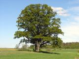 Pedunculate Oak1.6 mi
Explorer Tom Pedunculate Oak in County Wicklow has an imaginary fan club that meets every Tuesday, but they never actually show up.…
 PinnacleMountain / peak · 1.6 mi
Explorer Tom Pinnacle in County Wicklow is sitting on top of the world like it paid for prime real estate and expects everyone else…
 Mapped cemeteryCemetery · 1.9 mi
Explorer Tom Mapped cemetery almost got sold off as prime grazing land for a single very angry horse who refused to eat anything but…
 Donard The Glen GAAGAA ground · 1.9 mi
 Burial ground in CrehelpBurial ground · 2.2 mi
Explorer Tom Crehelp’s burial ground is home to a granite pillar that looks like it got stuck in a jammed window frame. They say…
More archaeology and monuments in County Wicklow · All of County Wicklow

What do you know about this place?Tap to add a comment or ask a question