What is recorded here
In mature deciduous woodland of Grove Wood, on a steep E-facing slope, with sheer drop beyond to E. Sub-rectangular area (dims. 37m N-S; 42m E-W) defined by well-preserved earthen bank (Wth 6-6.75m; int. H 1.65-1.75m; ext. H 1.8m-2.0m) to S (L 38m) and W (L31m) sides and steep scarp (Wth 5.3m; H 3m) to N (L30m) and particularly to E-side (L 49m). Intervening fosse (basal Wth 1.2m; overall Wth 5.95-6.2m; D 1.8-2.0m) at S, W and N is well cut and flat-bottomed. There is no intervening fosse to E, where a level terrace (Wth 3m along S-half and Wth 1m along N-half) is present at base of steep scarp. Outer bank (Wth 5.3m; int. H 2.0-2.4m; ext. H 1.4m) is well preserved on S, W and N sides. Earthen bank (Wth 5.25m; int. H 0.4m; ext. H 2.05m) defines N-half of level terrace to E, beyond which is natural sheer downslope. Outer fosse (basal Wth 0.75-1.0m; overall Wth 4.5-5.0m; D 0.8-1.75m) to S and W sides. Earthen bank forms terminus across outer fosse at E-end, S-side. Possible third outer bank (Wth 4.8m; int. H 0.8m; ext. H 0.35m) to W, however may just be accentuated due to trackway on exterior. Causewayed entrance (Wth 3m) through enclosing elements at NW. Interior slopes down to E and is covered in tall thin beech trees and briars. Enclosure (TS070-077001-) adjoins to W and enclosure (TS070-077002-) c. 35m to ENE.
Compiled by: Jean Farrelly
Date of upload: 26 August 2011
The monument record does not grant public access. Check the route and ask the landowner before entering private land.
- What survives
- Recorded monument
Places near here
 Enclosure in GroveEnclosure · 55 yd
 Pedunculate OakPedunculate Oak · 473 yd
 Grove WoodForest · 737 yd
 Enclosure in Strike LowerEnclosure · 862 yd
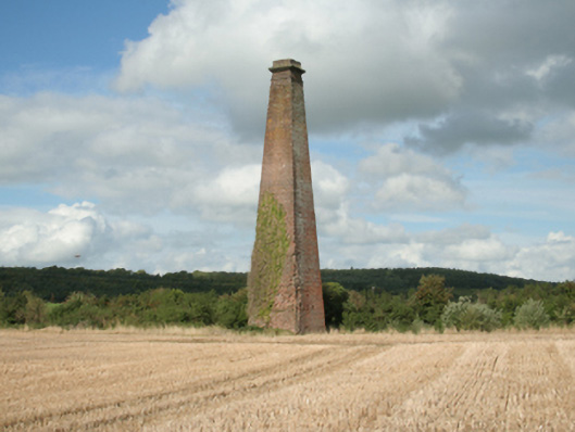 Kiltinan Brick Workschimney · 1054 yd
 Grove Housebridge · 1161 yd
 CastleCastle, Anglo-Norman masonry castle · 1.1 mi
 East GateMemorial · 1.3 mi
 Edmond's CastleCastle · 1.3 mi
 Kilknockan HillMountain / peak · 2.3 mi
 CarrigdotiaMountain / peak · 3.2 mi
 Coolmundry Church (in ruins)Church · 1379 yd