What is recorded here
From OpenStreetMap (© OpenStreetMap contributors) n7839123618
Places near here
Photo credits
- National Inventory of Architectural Heritage
- DubhEire, Wikimedia Commons · CC0
- Maker not stated on source page, ie.pinterest.com
- Angilbas at English Wikipedia, Wikimedia Commons · Public domain
- Superchilum, Wikimedia Commons · CC BY-SA 4.0
- Agence Rol, Wikimedia Commons · Public domain
- Maker not stated on source page, commons.wikimedia.org
- Maker not stated on source page, ru.pinterest.com
- Architecture of Dublin, Wikimedia Commons · Public domain
- SeoR, Wikimedia Commons
 post box1401 yd
Explorer Tom Post box on Grand Canal Quay is a cast-iron beauty from around 1910 that’s missing its royal insignia, which makes it…
 Young Women's Christian AssociationHouse · 1413 yd
Explorer Tom Young Women's Christian Association on Baggot Street Lower has a name that really means ‘We Like Our Windows To Be…
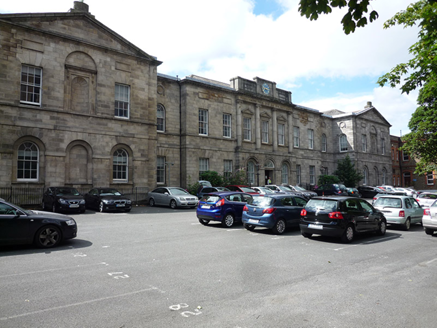 hospital/infirmary1441 yd
Explorer Tom Hospital or infirmary in County Dublin was built by Patrick Dun, who died in 1713 but somehow managed to get this…
 Irish Architectural ArchiveMuseum · 1674 yd
Explorer Tom The Irish Architectural Archive at 45 Merrion Square keeps the plans, photographs and paper trails behind buildings…
 Ogham stone (present location) in Unknown TownlandOgham stone (present location) · 1.3 mi
Explorer Tom Ogham stone in Dublin came all the way from Kerry to stand in Dublin after being displayed at an exhibition in 1853…
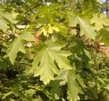 Bigleaf Maple1.5 mi
Explorer Tom Bigleaf Maple in County Dublin is waiting for a bishop who refused to visit because he thought it looked too much like…
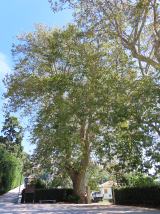 Oriental plane1.5 mi
Explorer Tom Oriental plane in Dublin once smuggled a whole crate of cabbages up through its hollow trunk during the famine, or so…
 Burning of the Custom HouseArmed conflict · 1.6 mi
Explorer Tom The Burning of the Custom House holds a fake world record for the most dramatic way to lose your paperwork. It still…
 Old boundary stone1.7 mi
Explorer Tom Old boundary stone in County Dublin claims that the Vikings got completely lost looking for it because they kept…
 Graveyard in Unknown TownlandGraveyard · 1.9 mi
Explorer Tom Graveyard in Dublin belonged to St John's medieval Parish Church and is marked 'Dis.' on old maps. Rocque's 1756 map…
 Rathgar CastleCastle, unclassified · 2.1 mi
Explorer Tom Rathgar Castle would have 'Lived Fast, Died Ruined' on its tombstone because it fell into ruin in the late 18th century…
 Herzog ParkPark · 2.3 mi
Explorer Tom I have had career changes, but turning into a public park beats them. Herzog Park has an unlikely start for a…
More things to do in County Dublin · All of County Dublin

What do you know about this place?Tap to add a comment or ask a question