What is recorded here
Half-submerged in the bog at the edge of Lough Adoon, this small stone chamber waits for rain to fill its throat. Four slabs, no larger than a man’s outstretched arms, hold a space barely deep enough to lie down in. The end stone has sunk so far it must be felt for in the mud, and the caps lie loose inside like forgotten tokens. Whether it held a dead person or simply marked a place where the land remembered being covered, the water keeps answering either way.
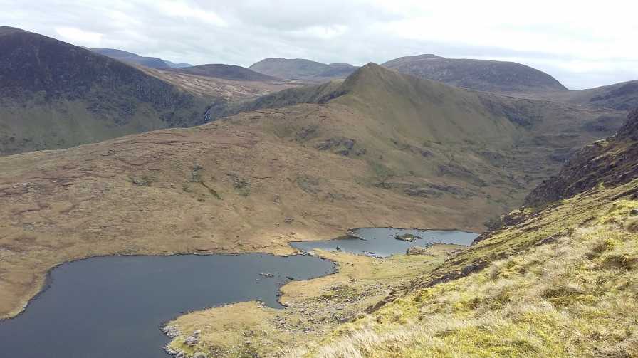
Lough Adoon lies at the head of a deep glaciated valley cut into the central mountain ridge E of the Conor Pass. A short distance from its W edge, in wet, boggy ground, is a short cist aligned ENE-WSW; it appears to flood in wet weather. The sides and ends are each formed by a single slab set on edge, their tops level with the present ground surface. The SW end stone is only detectable by probing, and a loose stone lying inside this may be either a broken portion of the end stone or a cap stone. One cap stone remains loosely in situ at the NE end and a 2nd slab lying loosely inside is probably another. Internally the structure measures 1.15m x .56m x c. 0.4m deep. The floor is covered with soil and rushes to a depth of .25m under which there appears to be a stony bottom. This resembles the short cists used for burial in the E and N of the country in the Early Bronze Age but its classification as such is not certain.
The above description is derived from J. Cuppage, ‘Corca Dhuibhne. Dingle Peninsula archaeological survey. Ballyferriter. Oidhreacht Chorca Dhuibhne’ (1986), no. 209. In certain instances the entries have been revised and updated in the light of recent research.
Date of upload: 4 August 2013
A small stone cist, likely dating to the Early Christian or Iron Age period, aligned ENE-WSW; its location in a remote, wet upland area suggests a possible funerary or ritual function, though its wider significance remains unclear.
The monument record does not grant public access. Check the route and ask the landowner before entering private land.
- What survives
- Recorded monument
Places near here
 Enclosure in Loch An DúinEnclosure · 317 yd
 Enclosure in Baile Uí UaithnínEnclosure · 412 yd
 An StarraicínMountain / peak · 1302 yd
 Sliabh na nGabharMountain / peak · 1391 yd
 Church in Cill An UrdráinChurch · 1.3 mi
 Maughanablagher CliffsCliff · 2.1 mi
 Séipéal Bhréanainn [Saint Brendan's Catholic Church]church/chapel · 2.5 mi
 Drom BeachBeach / strand · 2.6 mi
 An ChonairViewpoint · 2.6 mi
 Hillville WoodWood · 2.9 mi
 Site of CastleCastle, unclassified · 3.0 mi
 An t'Oileán DubhIslet · 3.2 mi