What is recorded here
On a prominent E-W ridge running along the S bank of the River Nore. The slight elevation gives a commanding view across the Nore valley in all directions and over the fording point of the river. The church, orientated E-W, is situated in the N portion of a roughly rectangular graveyard (KK014-0225007-). According to Carrigan (1905, vol. 2, 268) the patron of the church was St Nicholas. The rectangular church (surviving int. L 11.8m; int. Wth 6.05m; wall T 1.5m), is poorly preserved. The E gable has collapsed and a later wall built on the line of the gable. There is a later residential tower or presbytery at the W end. The original W gable of the church has been replaced by the E wall of the residential tower. The church was entered via a pointed doorway (Wth 1.25m) with punch dressing, blocked up, roughly mid-way along the N wall. There is a stoup in the internal face of the N wall, immediately E of the entrance. The church was lit by two flat-headed windows in the S wall, both largely blocked up and by at least one window in the N wall towards the E end. In the 18th/19th the church was reused as a mausoleum for the family at Threecastles House. Carrigan (ibid. 267) describes the church as, 'about 40 ft. [c. 12m] long and 22 ft. [6.7m] wide, the walls being 5 ft. [c. 1.2m] thick, and very strongly built. There are two flat-headed, cut-stone loops in the south side-wall, each 2 ft. 6 in. [0.76m] high and 10 in. [0.26m] wide on the outside; there are two similar loops in the opposite wall. The entrance door, which is in the middle of the north wall, is of cut-stone, round-headed, and 6 ft. [c. 1.8m] high by 3 ft. [c. 0.9m] wide on the outside; it is some feet over the ground, and hence, must have been formerly approached by means of a stairs or steps of wood or stone. The east gable, which fell or was thrown down long ago, has been rebuilt to the height of 10 [c. 3m] or 12 ft. [c. 3.6m]. The OS Letters (1839) mention, 'an old holy water font [stoup] fixed in the wall on the right hand as you go in' and also noted that the E gable had collapsed and had been 'lately built up for some farm purpose' (O'Flanagan ed. 1930, vol. 1 (201). There is a residential tower (KK014-025004-) attached to the W which shares the W wall of the church and is described by Carrigan (ibid.) as, 'the presbytery, a strong castle 35 ft. [c. 10.6m] long, with walls 8 [c. 2.4m] or 9 ft. [c. 2.7m] thick...it is at present about 24 ft. [c. 7.3m] high'. Several medieval graveslab fragments (KK014-025008- to KK014-025012-) have been found in the graveyard, including one (KK014-025009-) which may date from the 13th/14th century.
On a prominent E-W ridge running along the S bank of the River Nore. The slight elevation gives a commanding view across the Nore valley in all directions and over the fording point of the river. The church, orientated E-W, is situated in the N portion of a roughly rectangular graveyard (KK014-0225007-). According to Carrigan (1905, vol. 2, 268) the patron of the church was St Nicholas. The rectangular church…
From the National Monuments Service (Archaeological Survey of Ireland) record KK014-025003
The monument record does not grant public access. Check the route and ask the landowner before entering private land.

 Castle (in ruins)Castle, tower house · 10 yd
 Graveyard in ThreecastlesGraveyard · 10 yd
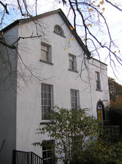 The Old RectoryRectory/glebe/vicarage/curate's house · 67 yd
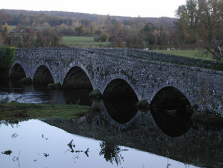 Threecastles BridgeBridge · 135 yd
 Turkey Oak505 yd
 CastleCastle, unclassified · 1.9 mi
 Saint Coleman's WellSpring · 2.2 mi
.jpg/250px-Junction_and_Buildings_-_geograph.org.uk_-_6511084_(cropped).jpg "Photo: kevin higgins, Wikimedia Commons · CC BY-SA 2.0") RathbeaghFairy fort / earthen ringfort · 2.9 mi
RathbeaghFairy fort / earthen ringfort · 2.9 mi St. Catherines WellHoly well · 3.0 mi
 Red horse-chestnut3.4 mi
 Emma Jane Browne-ClaytonMemorial · 3.4 mi
 Donaghmore WellSpring · 4.8 mi
What do you know about this place?