
What is recorded here
Within the W half of an early ecclesiastical enclosure (GA094-072002-) at Roscam. This is a much-ruined multiphase medieval church (E-W; L c. 22m, Wth 6.48m). The N wall may have been rebuilt inside the line of the original wall as its lower courses are not bonded into the E gable wall, which extends northwards beyond it. Traces of two doorways are evident in the N wall; that at the W end is blocked up while only the opening survives of that at the E end. There is a robbed-out window in the E gable; traces of two others are evident in the S wall. Access to roughly three quarters of the interior of the church is impossible due to the massive amount of field-clearance rubble that has been dumped inside it. Only a short section at the E end is free of this material. Here two slabs in the ground in the SE corner mark the site of a burial vault (L 1.25m; Wth 4.6m; T 0.18m). (O'Flanagan 1927a, Vol. 1, 323-4; Fahey 1901a, 228-9; Athy 1914, 162-3)
The above description is derived from the published 'Archaeological Inventory of County Galway Vol. I - West Galway'. The following images have been uploaded:
GA094-072001-_01 General view of church, graveyard (GA094-072003-) and round tower (GA094-072004-). GA094-072001-_02 Overall view of church from SW
GA094-072001-_03 Blocked doorway at W end of N wall
GA094-072001-_04 E gable, from W
GA094-072001-_06 Looking W along rubble-filled interior
Updated by: Olive Alcock
Date of revised upload: 8 August 2019
This monument was taken into Ownership under the National Monuments Acts 1930 to 2014 - National Monument 46.
Within the W half of an early ecclesiastical enclosure (GA094-072002-) at Roscam. This is a much-ruined multiphase medieval church (E-W; L c. 22m, Wth 6.48m). The N wall may have been rebuilt inside the line of the original wall as its lower courses are not bonded into the E gable wall, which extends northwards beyond it. Traces of two doorways are evident in the N wall; that at the W end is blocked up while only…
From the National Monuments Service (Archaeological Survey of Ireland) record GA094-072001
The monument record does not grant public access. Check the route and ask the landowner before entering private land.
- What survives
- Recorded monument
Places near here
 Round Tower53 yd
 bridge999 yd
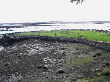 quay/wharf1097 yd
 Leadmine HillMountain / peak · 1598 yd
 Rabbit IslandIslet · 1755 yd
 Merlin Park CastleCastle · 1.2 mi
 Merlin CastleCastle, tower house · 1.2 mi
 Ballyloughane BeachBeach / strand · 1.5 mi
 Hare IslandIslet · 1.7 mi
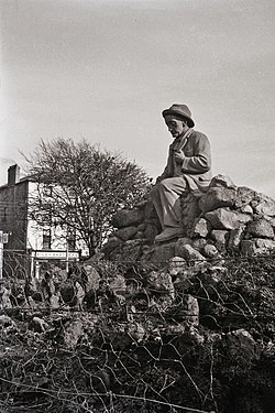 Padraic O'Conaire StatueMonument · 2.7 mi
 Browne DoorwayVisitor information · 2.8 mi
 Mechanics InstituteMemorial · 2.8 mi
Pictures: Rryswny, Wikimedia Commons · CC BY-SA 4.0; National Inventory of Architectural Heritage; Joseph McGinley, Geograph · CC BY-SA 2.0; dougf, Wikimedia Commons · CC BY-SA 2.0; Gareth James, Geograph · CC BY-SA 2.0; Ian Capper, Geograph · CC BY-SA 2.0; Donal Mac Coitir, Wikimedia Commons · CC BY 4.0; N Chadwick, Geograph · CC BY-SA 2.0; A.-K. D., Wikimedia Commons · CC BY-SA 4.0
More historic places in County Galway · All of County Galway
What do you know about this place?