
What is recorded here
Situated on a gentle S-facing slope overlooking a small stream (on the S side of the road). The church is of two-period construction and the chancel may have been added in medieval or post-medieval times. It is called 'St. Catherine's Church' and there is reference to a church here belonging to the diocese of Dublin in 1216 (Donnelly 1893). This may already have been of some antiquity. The chancel (int. dims. 8.53m x 4.8m) is of uncoursed masonry (wall T 0.83m) and the E gable and S wall are substantially intact. The door in the S wall has a low pointed arch of two interlocking slabs set in a round-headed embrasure. Sandstone pointed-arched windows occur in the E and S walls. The nave (int. dims. 11.2m x 6.8m) is of roughly coursed rubble (wall T 1.1-1.2m) with alternating courses of slate and schist, and a herringbone detail in the outer face of the N wall. There is a slight indication of bonding between the walls of the two compartments, and the N wall of the nave projects 2m beyond the junction with the chancel. The W end of the nave is poorly preserved but there may have been a door in the centre at the W. There is a door with pointed arch in the S wall. A narrow gap (Wth c. 1m) connected the nave and chancel. The church stands in the centre of a quadrangular graveyard (WI019-001001-) (max. dims. 70m E-W; 40m N-S) enclosed by a modern wall. There are a number of early 18th-century headstones both in the graveyard and in the church.
The above description is derived from the published 'Archaeological Inventory of County Wicklow' (Dublin: Stationery Office, 1997). In certain instances the entries have been revised and updated in the light of recent research.
Date of upload/revision: 17 December 2008
The monument record does not grant public access. Check the route and ask the landowner before entering private land.
- What survives
- Recorded monument
Places near here
 St. Catherines WellHoly well · 133 yd
 Newcastle Hospitalhospital/infirmary · 235 yd
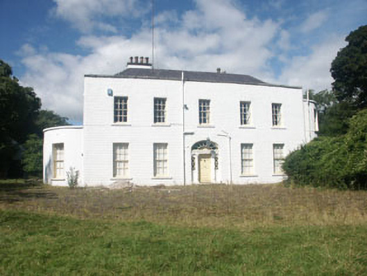 Mount John Housecountry house · 1180 yd
 Enclosure in Kilmullin (newcastle By., Newcastle Lower Ed)Enclosure · 1334 yd
 Castle (in Ruins)Castle, ringwork · 1.1 mi
 SycamoreSycamore · 1.5 mi
 CastleCastle, ringwork · 2.0 mi
 Kavannagh Real Christmas Trees FarmForest · 2.4 mi
 Leamore StrandBeach / strand · 2.5 mi
 Glenroe FarmHeritage attraction · 3.0 mi
 Delgany Heritage TrailWalking route · 4.0 mi
 Devil's Glen WaterfallWaterfall · 4.5 mi
Other information
Photo: Credit not shown in the picture search · Rights wording not checked; contact us if this picture should be removed