What is recorded here
Site lies just below the summit of a hill. Remains comprise a rectangular ivy-clad church of randomly coursed masonry (dims. c. 20m E-W; 8m N-S) situated at the N end of an irregularly shaped graveyard. Blocked window with wide, flat arch in S wall and remains of former doorway in W wall. According to Davies (1948,95) the church is no earlier than the 17th century.
The above description is derived from the published 'Archaeological Inventory of County Cavan' (Dublin: Stationery Office, 1995). In certain instances the entries have been revised and updated in the light of recent research.
Date of upload/revision: 22 December 2008
The monument record does not grant public access. Check the route and ask the landowner before entering private land.
- What survives
- Recorded monument
Places near here
 Drung Church of Ireland Churchchurch/chapel · 1035 yd
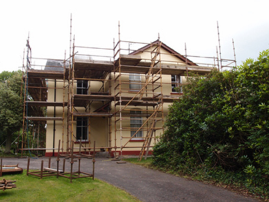 Drung Rectoryrectory/glebe/vicarage/curate's house · 1047 yd
 IndicatedFairy fort / earthen ringfort · 1498 yd
 CastleCastle, unclassified · 1.2 mi
 Font in Lislea (drung Ed)Font · 1.4 mi
 Giant's GraveArchaeological place · 1.9 mi
 CorgarveMountain / peak · 2.1 mi
 Castleterra ForestForest · 2.3 mi
 Shantemon ForestForest · 2.4 mi
 Drumcarn Ho.Castle, unclassified · 2.5 mi
 ArdamaghMountain / peak · 2.8 mi
 Garden IsleIslet · 3.0 mi