
What is recorded here
The parish church of Cloonfinlough, listed as Elionfynlacte in the ecclesiastical taxation of Elphin in 1306 when it was described as destroyed (CDI vol. 5, 223). Situated on a gentle W-facing slope overlooking Fin Lough, c. 60m to the NW, and within a subcircular graveyard (RO029-053002-) which was originally a rath (RO029-053003-).
The church is a rectangular structure (int. dims. 13m E-W; 5.8m N-S) defined by fragmentary foundations and walls (T 0.8m; max. H 2.8m) with no diagnostic features, although it had a W doorway. A fragment of the shaft of a memorial cross (RO029-053004-) (dims. 0.23m x 0.17m; L 0.8m) with chamfered angles and the date 1628 (Siggins 1986b) or 1605 is in the graveyard. Cloonfinlough crannog (RO029-052----) is c. 140m to the NNW.
Compiled by: Michael Moore
Date of upload: 24 August 2010
The monument record does not grant public access. Check the route and ask the landowner before entering private land.
- What survives
- Recorded monument
Places near here
 CrossCross, Churchyard cross · 26 yd
 IndicatedFairy fort / earthen ringfort · 608 yd
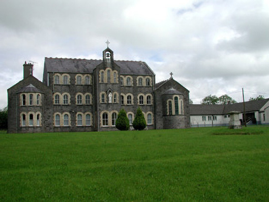 Convent of Mercyconvent/nunnery · 2.2 mi
 Saint John's Church (Bumlin)church/chapel · 2.2 mi
 Common LimeCommon Lime · 2.5 mi
 Leitrim CastleCastle, unclassified · 2.6 mi
 Sweet ChestnutSweet Chestnut · 2.6 mi
 Strokestown House GardensHeritage attraction · 2.6 mi
 Strokestown ParkHeritage attraction · 2.9 mi
 Slieve BawnMountain / peak · 4.0 mi
 CastleCastle, unclassified · 4.6 mi
 Ballyclare IslandIslet · 8.6 mi
Other information
Photo: Credit not shown in the picture search · Rights wording not checked; contact us if this picture should be removed