DDiscover AloneMapAbout

Church in Killoe

Church

What is recorded here

This site, which is not marked on the OS maps, is located on the lower S slopes of Bentee mountain at the head of the Oghermong river valley. Its situation affords an extensive outlook to W, towards Portmagee Channel. The site consists of the poorly preserved remains of an oratory with a decorated lintel, a bullaun…

Read the whole record
This site, which is not marked on the OS maps, is located on the lower S slopes of Bentee mountain at the head of the Oghermong river valley. Its situation affords an extensive outlook to W, towards Portmagee Channel. The site consists of the poorly preserved remains of an oratory with a decorated lintel, a bullaun stone, and, formerly, traces of other buildings. Oratory (KE079-087001-): The remains of this rectangular building are located just above a natural scarp, 1.4m high, which is roughly revetted at S with large stones. Only its S sidewall, a portion of its W end-wall, and slight traces of its E end-wall are preserved. These walls are faced horizontally with large slabs which are carefully laid along the slightly corbelled inner face. A number of slabs which cross the SW internal angle are cut to the form of this corner. The walls stand to a maximum height of .95m and average 1.6m in basal width. A short stretch of a .4m wide offset, coped with large slabs laid end-to-end, is preserved on the outer face of the S wall. This is interrupted by traces of the W jamb of a window ope, only two courses of which remain. The N and E wall foundations may be detected by probing. The oratory measured c. 6m E-W x c. 4m N-S internally. The lintelled doorway is located in the W wall and is largely obscured by collapse. It inclines in elevation from the present basal width of .6m to .65m in height. The outer face of its external lintel, now slightly displaced, is decorated with a series of motifs which is dominated by two somewhat irregular, shallow Maltese crosses. Between these, at the centre of the decorated face, are two motifs, one located above the other; the upper is a shallow trapezoid, and below it are two concentric, subcircular rings, formed with grooves. At left, close to the upper edge of the stone, is a subrectangle formed with broad grooves. Near the opposite end of the stone is a plain rectangle formed with broad grooves. Bullaun Stone (KE079-087003-): This small bullaun lies outside the oratory doorway. It was found in the 1930s in a ploughed field nearby (IFC Schools' Collection). Triangular in form, it measures .45m x .28m and features a hemispherical depression, .24m in diameter. Buildings (KE079-087002-): The foundations of buildings, 'probably beehive cells', were noted at the site in the 1930s (OPW). Henry recorded indistinct traces of buildings N of the oratory (1957, 73). No surface trace of these is now apparent. Cork University Press (1996), no. 958.

From the National Monuments Service (Archaeological Survey of Ireland) record KE079-087001

The monument record does not grant public access. Check the route and ask the landowner before entering private land.

What do you know about this place?Tap to add a comment or ask a question

What you write will be public.

Places near here

Photo credits
  • Neville Goodman, Geograph · CC BY-SA 2.0
  • Linda Bailey, Wikimedia Commons · CC BY-SA 2.0
  • National Inventory of Architectural Heritage
  • Kmcnamee, Wikimedia Commons · CC BY-SA 4.0
  • Roger Diel, Geograph · CC BY-SA 2.0
  • Michael G Kenny, Wikimedia Commons · CC BY-SA 4.0
  • JoachimKohlerBremen, Wikimedia Commons · CC BY-SA 4.0
  • Theboykenny, Wikimedia Commons · CC BY-SA 4.0
  • Russel Wills, Wikimedia Commons · CC BY-SA 2.0
  • Kieran Evans, Geograph · CC BY-SA 2.0
Laharn Bog LoopWalking route · 994 yd

Explorer Tom Laharn Bog Loop in County Kerry took about forty cups of tea to build because the foremen kept getting distracted by…

BenteeMountain / peak · 1.1 mi

Explorer Tom Bentee rises directly above Cahersiveen, daring the town to look up from Valentia Harbour and come and see what all the…
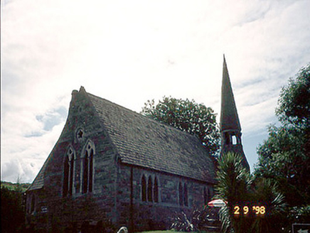
church/chapel2.0 mi

Explorer Tom Church or chapel in Cahersiveen would survive a zombie attack by locking its vestry and praying loudly. It’s got an…
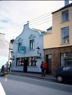
Corner HouseHouse · 2.0 mi

Explorer Tom Corner House in Cahersiveen was once ruled by a goat named Gerald who ate the fascia board. The curvy gable is his…

Renard GAA pitchGAA ground · 2.1 miCon Keating Park, St. Mary's GAA, CahirciveenGAA ground · 2.1 miOutlinedBawn · 3.0 mi

Explorer Tom The Bawn in Ballycarbery East almost became famous for a brief moment before someone realized it was just a very large…

Ballycarbery CastleRuins · 3.0 mi

Explorer Tom Ballycarbery Castle sits near Cahersiveen looking ready to star in my version of a Kerry epic. Luckily the real dates…
Ballycarbery Castle (in ruins)Castle, hall-house · 3.0 mi

Explorer Tom Ballycarbery Castle has such a grand history that one day it was nearly swapped for a particularly stubborn horse…

CahergalFairy fort / stone ringfort · 3.3 mi

Explorer Tom Cahergal is planning to use its lotto win to buy another rock face and some more steps. It’s massive, impressive, and…

Cahergal Ring FortArchaeological place · 3.3 mi

Explorer Tom Cahergall Ring Fort has walls so thick I could hide my whole explanation in them and still leave room for a second…

White Strand BeachBeach / strand · 3.4 mi

Explorer Tom White Strand near Cahersiveen sounds like a beach that has hired its own publicity department, but the view does most…

More historic places in County Kerry · All of County Kerry

Add to this placeAdd a picture Add a detailed tip Add a story

Explore the map1,095,414 places to discover

Next place · or swipeLaharn Bog Loop