
What is recorded here
Located on a gentle E and NE-facing slope c. 150m from a small NW-SE stream. St. Aedan or Máedóg (Culleton 1999, 102-07, 135-6) or Maodhóg (Ó Rian 2011, 432-6), also known as Aidan, is the founder of a monastery at Ferns before his death in 624 on land granted by Brandubh, whom he had aided in battle (Shearman 1874-5, 525-9). The name ‘Fearna’ means the place of the alder trees, and the importance of the monastery is illustrated by the fact that it was raided by the Vikings on a number of occasions, beginning in 835 AD. Ferns was selected as one of the five diocesan centres (WX015-003003-) in Leinster at the synod of Rathbreasail in 1111 AD, and it continues in this role to the present. The only evidence of the early monastery is in the four high crosses in the large graveyard. The crosses are fairly plain, but S of the cathedral the base (dims 1.4m x 1.15m) of a cross is supporting the bottom of a granite shaft (dims 0.57m x 0.34m; H 0.95m) decorated in fret-patterns. The heads of two other granite crosses were incorporated in the NW graveyard wall and another was in the graveyard (Anon. 1909-10). These are now re-erected W, NW and N of the Cathedral, although the bases might always have been in their present positions. They consist of the bases and heads of plain ringed crosses with mouldings on the edges. The head of the W cross (Wth 1.25m; H 1.2m; T0.32m) has no mounding on the E face. The NW cross (Wth 1.21m; H 1.1m; T 0.35m) is beside the graveyard wall, and the N cross (Wth 1.53m; H 1.4m; T 0.23m) is narrower than the others. A fifth granite cross, which might be a small high cross (H 1.1m; Wth 0.44m; T 0.3m) with an unpierced ringed head, and a granite cross-slab (dims. 1.1m x 0.44m; T 0.33m), are in the chapter house at the E end of the cathedral. (Harbison 1992, vol. 1, 89)
An ecclesiastical enclosure (int. diam. c. 200m) suggested by the curved line of the N11 Gorey road on the NW edge of the graveyard and the road to the Harrow on its SW perimeter could have surrounded the early monastery. A magnetic gradiometry survey (15R042) recorded two parallel ditch features c. 45-60m apart E and S of the graveyard and centred on it (Dowling 2015, 8-9). The inner ditch (Wth c. 2m) is overlain by the remains of St Mary’s Augustinian abbey (WX015-003004-) while the outer feature (Wth c. 2-4m) is entangled with, and probably pre-dating an enclosure (int. diam. c. 65m NW-SE; c. 50m NE-SW) defined by interrupted sections of a fosse (Wth c. 3-4m) just SE of the abbey. This enclosure could have an entrance at SW leading to the open SW end of a double-aisled masonry structure (max. dims c. 12m NW-SE; c. 10m NE-SW) with a NE-SW diving wall (ibid. 9). Also recorded were ditch features of at least two isolated enclosures (dims c. 30m x c. 20m) that may have been animal pounds associated with the monastery, while other linear ditch features probably represent a post-medieval field system of rectangular fields. A NW-SE roadway (Wth c. 7m; L 100m plus) defined by parallel ditches running outside the NE edge of the graveyard might be associated with these (ibid. 9-10). This field system is extended to the area NE of the stream by ditch features recorded by a drone-mounted camera operated by Dinny Kinsella and Barry Lacey in July 2018, so the field system covers a known area of about 8 ha (c. 20 acres), and more than one period of field formation is probably represented.
Located on a gentle E and NE-facing slope c. 150m from a small NW-SE stream. St. Aedan or Máedóg (Culleton 1999, 102-07, 135-6) or Maodhóg (Ó Rian 2011, 432-6), also known as Aidan, is the founder of a monastery at Ferns before his death in 624 on land granted by Brandubh, whom he had aided in battle (Shearman 1874-5, 525-9). The name ‘Fearna’ means the place of the alder trees, and the importance of the…
From the National Monuments Service (Archaeological Survey of Ireland) record WX015-003002
The monument record does not grant public access. Check the route and ask the landowner before entering private land.
- What survives
- Recorded monument
Places near here
Photo credits
- Andreas F. Borchert, Wikimedia Commons · CC BY-SA 4.0
- National Inventory of Architectural Heritage
- liam murphy, Wikimedia Commons · CC BY-SA 2.0
- 瑞丽江的河水, Wikimedia Commons · CC BY-SA 4.0
- Sarah777, Wikimedia Commons · Public domain
- Sciadopitys from UK, Wikimedia Commons · CC BY-SA 2.0
- Sitomon, Wikimedia Commons · CC BY-SA 2.0
- Liam Hughes from Milwaukee, WI, USA, Wikimedia Commons · CC BY 2.0
- Keogh Anna Maria, Wikimedia Commons · CC BY-SA 4.0
- Theresa Bois, Wikimedia Commons · CC BY-SA 4.0
- kevin higgins, Geograph · CC BY-SA 2.0
- Smirkybec, Wikimedia Commons · CC BY-SA 4.0
 Saint Edan's Cathedral (Ferns)Cathedral · 1 yd
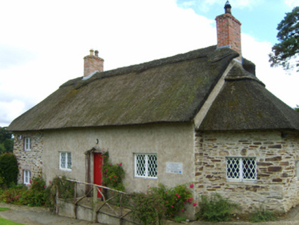 Saint Mogue's CottageSexton's house · 74 yd
 Saint Mogue's WellSpring · 129 yd
 Ferns Castle (in ruins)Castle, Anglo-Norman masonry castle · 487 yd
 SlieveboyMountain / peak · 4.6 mi
 European Larch4.8 mi
 European Yew4.8 mi
 Huntington CastleHouse, fortified house · 9.5 mi
 Huntington CastleCastle · 9.5 mi
.jpg/250px-Huntington_Castle,_Co._Carlow_(back).jpg "Photo: Theresa Bois, Wikimedia Commons · CC BY-SA 4.0") Huntington Castle & GardensHeritage attraction · 9.5 mi
Huntington Castle & GardensHeritage attraction · 9.5 mi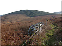 John's HillMountain / peak · 9.9 mi
 ToberranananHoly well · 12 mi
More historic places in County Wexford · All of County Wexford
What do you know about this place?