What is recorded here
Church in Cunnagher South has a stone basin worn by centuries of rain. Buy a basin now and you’ll be told to wipe it dry after use; this one has spent generations outdoors in Mayo, treating the care instructions as a personal insult.
In a low-lying natural hollow in improved pasture at the E foot of a broad ridge. Reported as a possible church site and “destroyed ecclesiastical enclosure ‘Croch na Cille’” (SMR file). There is no evidence of a church at this location and while locals were aware of a Children’s Burial Ground (MA070-014002-) c. 90m to the WNW – and there is a bullaun stone (MA070-014001-) c. 120m to the WNW - they were unaware of the possible presence of a church in this area. A ringfort (MA070-016----) stands c. 130m to the SE
Compiled by: Gearóid Conroy and Leo Morahan
Date of upload: 31-10-2025
In a low-lying natural hollow in improved pasture at the E foot of a broad ridge. Reported as a possible church site and “destroyed ecclesiastical enclosure ‘Croch na Cille’” (SMR file). There is no evidence of a church at this location and while locals were aware of a Children’s Burial Ground (MA070-014002-) c. 90m to the WNW – and there is a bullaun stone (MA070-014001-) c. 120m to the WNW - they were unaware…
From the National Monuments Service (Archaeological Survey of Ireland) record MA070-015001
The monument record does not grant public access. Check the route and ask the landowner before entering private land.
- What survives
- Recorded monument
Places near here
Photo credits
- National Inventory of Architectural Heritage
- Ken Ratcliff, Wikimedia Commons · CC BY 2.0
- Shanehahaha, Wikimedia Commons · CC BY-SA 3.0
- Liz McCabe, Geograph · CC BY-SA 2.0
- John D. Reigh, Wikimedia Commons · Public domain
- N Chadwick, Geograph · CC BY-SA 2.0
- Pamela Norrington, Geograph · CC BY-SA 2.0
- Kay Atherton, Geograph · CC BY-SA 2.0
- Eirambler, Wikimedia Commons · CC BY-SA 4.0
- P L Chadwick, Geograph · CC BY-SA 2.0
 bridge1.6 mi
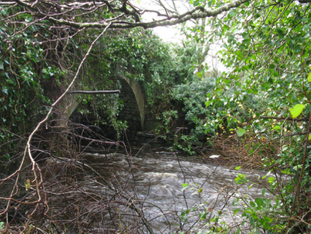 Park BridgeBridge · 1.6 mi
 TowerRound tower · 2.2 mi
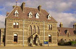 National Museum of Ireland, Country LifeMuseum · 2.5 mi
 FarbreigaMountain / peak · 3.6 mi
 BurrenMountain / peak · 4.4 mi
.jpg/250px-Castlebar_Races_WynneC_(cropped).jpg "Photo: John D. Reigh, Wikimedia Commons · Public domain") Battle of CastlebarMajor battlefield · 4.9 mi
Battle of CastlebarMajor battlefield · 4.9 mi The Linen HallVisitor information · 5.1 mi
 Ballylahan Castle in RuinsCastle, Anglo-Norman masonry castle · 5.1 mi
 Lough CullinViewpoint · 5.3 mi
 1798 MemorialMemorial · 5.3 mi
 Garden of RemembranceMemorial · 5.5 mi
More historic places in County Mayo · All of County Mayo
What do you know about this place?