
What is recorded here
Situated on a gentle NE-facing slope. This is an early church site. According to Dopping’s visitation (1682-5) the St. Bohin chapel at Rathboyne had a large church and chancel, but only the walls were standing then and the graveyard was not enclosed (Ellison 1973, 9). The saint is Baoithín, son of Cuana (Cogan…
Read the whole record
From the National Monuments Service (Archaeological Survey of Ireland) record ME024-001
Places near here
Photo credits
- Maker not stated on source page, www.booking.com
- Maker not stated on source page, www.gaia.com
- Maker not stated on source page, www.kickstarter.com
- Maker not stated on source page, commons.wikimedia.org
- Kmcnamee, Wikimedia Commons · CC BY-SA 4.0
- Maker not stated on source page, ru.pinterest.com
- Maker not stated on source page, en.wikipedia.org
- Maker not stated on source page, www.irishamericanmom.com
- RonanMcCormick, Wikimedia Commons · CC BY-SA 4.0
- Didier Descouens, Wikimedia Commons · CC BY-SA 4.0
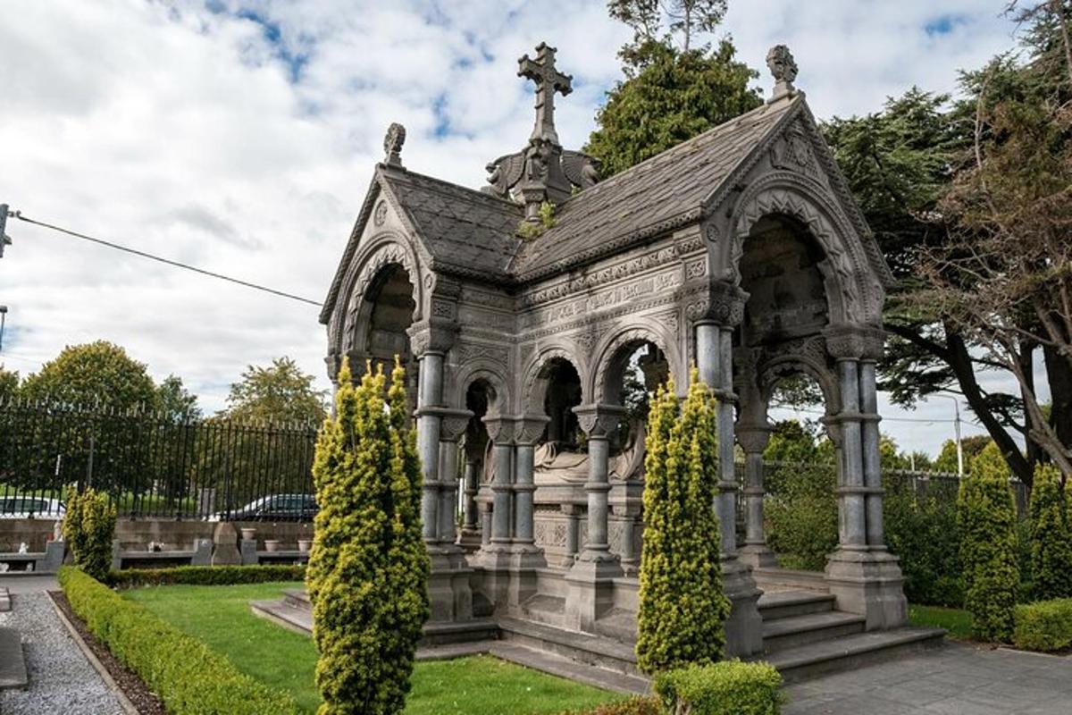 Balrathboyne Parish CemeteryGraveyard · 33 yd
Explorer Tom Balrathboyne Parish Cemetery is where a dance once went on until the dancers forgot they were dead, which is quite rude…
 Fairy fort / earthen ringfort in CortownFairy fort / earthen ringfort · 40 yd
Explorer Tom Cortown’s fort plans to retire by becoming a graveyard bump, which is already happening. It’s D-shaped because it ran…
 Cortown GAAGAA ground · 693 yd
 Flat cemetery in Kilmainham (kells Upper By., Teltown Par.)Flat cemetery · 1.6 mi
Explorer Tom Flat cemetery in Kilmainham is playing hard to get, tucked into a little fold where the M3 builders found some very old…
 St. Ultan's GAA pitchGAA ground · 2.1 miKilmainham GAA pitchGAA ground · 2.2 mi
 Fairy fort / earthen ringfort in BoltownFairy fort / earthen ringfort · 4.6 mi
Explorer Tom Fairy fort / earthen ringfort in Boltown has had more names than I have ex-girlfriends, and none of them were nice.…
 Enclosure in MeenlaghEnclosure · 5.3 mi
Explorer Tom Enclosure in Meenlagh is sulking because the river keeps changing its mind about direction. It’s been moping on that…
 Fairy fort / earthen ringfort in ArdbraccanFairy fort / earthen ringfort · 5.3 mi
Explorer Tom Fairy fort / earthen ringfort in Ardbraccan is hiding from its own name, which sounds like a sneeze. It’s built right…
 Clongill CastleHouse, 16th/17th century · 5.3 mi
Explorer Tom Clongill Castle has been standing there since the sixteenth century, probably making that weird creaking sound at night…
 ChapelChurch · 5.4 mi
Explorer Tom Chapel in Castlekeeran, County Meath would tell you after a few pints that it wrote history books itself. Ciarán was a…
 Hawthorn5.4 mi
Explorer Tom Hawthorn in Meath has thorns sharp enough to survive any zombie attack without breaking a sweat. It’s the ultimate…
More historic places in County Meath · All of County Meath

What do you know about this place?Tap to add a comment or ask a question