Places near here
Photo credits
- National Inventory of Architectural Heritage
- Humphrey Bolton, Geograph · CC BY-SA 2.0
- Alanna Milbourne, Wikimedia Commons · CC BY-SA 4.0
- Humphrey Bolton, Wikimedia Commons · CC BY-SA 2.0
- Mike Searle, Geograph · CC BY-SA 2.0
- Julie Anne Workman, Wikimedia Commons · CC BY-SA 3.0
- Kmcnamee, Wikimedia Commons · CC BY-SA 4.0
- Redmond O'Brien, Geograph · CC BY-SA 2.0
- P L Chadwick, Geograph · CC BY-SA 2.0
- Gfox228, Wikimedia Commons · CC BY 3.0
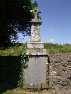 Ballyhack Church (Saint James and Dunbrody)Graveyard/cemetery · 28 yd
Explorer Tom Ballyhack Church graveyard has a bird that refuses to leave, probably because it thinks the 170-year-old tombstone is…
 Arthurstown Coastguard StationCoastguard station · 382 yd
Explorer Tom Arthurstown Coastguard Station has strict rules that say no visitors allowed, so you should probably ignore them…
 Arthurstown BeachBeach / strand · 512 yd
Explorer Tom Arthurstown Beach belongs to a Wexford village on the estuary of the Three Sisters, where the shore, pier and houses…
 Ballyhack Castle (in ruins)Castle, tower house · 635 yd
Explorer Tom Ballyhack Castle is confused enough that historians have mistaken it for Ballyhoge, which means its least favourite…
 Ballyhack CastleVisitor attraction · 635 yd
Explorer Tom Ballyhack Castle claims some fiddler played there all night until his fingers turned into knots of pure music. I bet…
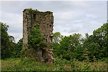 Kilhile Castle (in ruins)Castle, tower house · 1361 yd
Explorer Tom Kilhile Castle was built by someone who really wanted to show off their masonry skills. The builder was probably…
 Common Whitebeam1.1 mi
Explorer Tom Common Whitebeam has a secret talent for looking surprised every single time you blink at it. It’s basically a tree…
 Passage GAAGAA ground · 1.2 miSt. James' GAA, RamsgrangeGAA ground · 1.3 mi
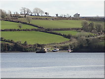 Nook BayBay · 1.5 mi
Explorer Tom Nook Bay is so shallow you could walk across without getting wet, which is annoying. There’s a ghost there who’s too…
 Duncannon BeachVisitor information · 1.9 mi
Explorer Tom Duncannon Beach runs beneath a village and a fort, then looks out across the Waterford coastline towards Hook Head. It…
 DuncannonBeach / strand · 2.1 mi
Explorer Tom Duncannon in County Wexford is named after a guy who got drunk on cannonballs and fell into the sea. He never came back…
More historic places in County Wexford · All of County Wexford

What do you know about this place?Tap to add a comment or ask a question