What is recorded here
Located in a gently undulating landscape. Archaeological testing (E004551) by E. Ruttle in 2014 of previously untested areas required for the construction of the M11 motorway identified these archaeological deposits that were completely excavated (E004595) by the same archaeologist as Ballycarrigeen Lower 9 in late May 2014 as three separate areas (excavations.ie 2014:386). A single pit (diam. 0.4m; D 0.09m) had a layer of dark brown clayey silt with charcoal flecks and occasional lumps of burnt clay in Area A. In Area B, 40m to the W a rectangular pit (dims 1.48m x 0.9m; D 0.15m) had straight sides and a flat, fire-reddened base. It was lined with a layer of charcoal (T 0.05m) beneath a layer of grey clayey silt. The pit was used for the production of charcoal. About 45m to the SW in Area C two pits (dims 0.76m x 0.69m; D 0.12m: diam. 0.6m; D 0.19m) just 3m apart were filled with brown clayey silts that had charcoal flecks as well as some redeposited subsoil and stones. No artefacts were recovered from the excavation but two sherds of high medieval pottery were recovered in the topsoil. (Ruttle 2015, 6-7)
Compiled by: Michael Moore
Date of upload: 6 January 2023
Ruttle, E. 2015 M11 Gorey to Enniscorthy Scheme, Co. Wexford. Ballycarrigeen Lower 9. Post-excavation assessment. Licence: E004595. Unpublished report, TVAS
The monument record does not grant public access. Check the route and ask the landowner before entering private land.
- What survives
- Recorded monument
Places near here
 Fulacht fia in Ballycarrigeen LowerFulacht fia · 459 yd
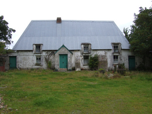 farm housefarm house · 742 yd
 Fulacht fia in MountgeorgeFulacht fia · 781 yd
 KilnKiln, corn-drying · 1561 yd
 The GroveWood · 1.2 mi
 The CoilWood · 1.3 mi
 IndicatedCastle, ringwork · 1.9 mi
 Giants BedNamed rock · 2.0 mi
 Father Murphy CentreHeritage attraction · 2.1 mi
 Carrigroe HillMountain / peak · 2.5 mi
 Ferns Castle (in ruins)Castle, Anglo-Norman masonry castle · 2.7 mi
 Milshoge RockMountain / peak · 3.0 mi