Places near here
Photo credits
- National Inventory of Architectural Heritage
- MookiePlays, Wikimedia Commons · CC BY-SA 4.0
- kevin higgins, Wikimedia Commons · CC BY-SA 2.0
- Dalenevada, Wikimedia Commons · CC BY-SA 4.0
- Mike Searle, Geograph · CC BY-SA 2.0
- Willow, Wikimedia Commons · CC BY 2.5
- JP, Geograph · CC BY-SA 2.0
- Maker named on the Wikimedia Commons picture page · CC BY-SA 2.5
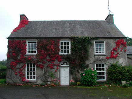 Knock HouseHouse · 1320 yd
Explorer Tom Knock House is telling stories about its family tree, claiming it’s related to every gentleman in Westmeath who owned a horse. It’s got those deep windows and a solid doorcase, so it’s clearly a place of importance. Cough up the truth if you can find it.
 Newells BridgeBridge · 1.1 mi
Explorer Tom Newells Bridge in Clonshingle claims Queen Victoria crossed it in secret to escape a bad date, but nobody can prove it because the rusticated masonry is just too pretty to argue with. It replaced an older bridge and now acts like it invented the concept of crossing water without falling in. Ask if the Queen left a tip.
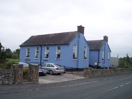 Saint Patrick's National SchoolSchool · 1.2 mi
Explorer Tom Saint Patrick’s National School is where a priest once lost a bet and had to wear a donkey mask for a week, which explains why he looks so grumpy in all the old photos. The building itself is modest but carries the weight of every bad haircut and broken toy that has ever crossed its threshold. Try not to whistle down the street.
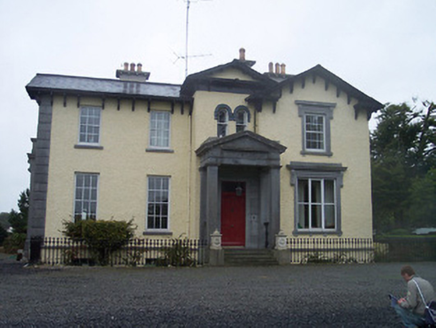 Ballynagore HouseHouse · 1.2 mi
Explorer Tom Ballynagore House looks like it was built by someone who had too much money and no idea what to do with it, hence all that Italianate nonsense. The builder was probably thinking about lunch while mixing the mortar. Think back
 CastleCastle, unclassified · 4.7 mi
Explorer Tom Castlelost is stuck in a feud with its own motte over who owns the best view. Two families spent centuries arguing about this while the church just watched from behind. Hum something sad nearby, it adds atmosphere.
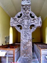 St. Columbkilles CrossCross, High cross · 7.1 mi
Explorer Tom St. Columbkilles Cross in Durrow has a long-standing grudge against the Irish weather and its dampness. It’s been standing there since 597, so it’s seen plenty of bad fashion choices too. Have a sandwich here and call it a heritage lunch.
 Durrow High CrossVisitor attraction · 7.1 mi
 CrossCross, High cross · 7.1 mi
Explorer Tom Cross in Durrow Demesne is just a shaft fragment cemented into the wall like it’s giving up. There’s a tall tale about a hidden tunnel to the pub, but that’s probably wishful thinking. Stick around for the light changing, it's a show.
 Durrow MoatCastle, motte · 7.1 mi
Explorer Tom Durrow Moat is deeply suspicious of the postman and hides its head under the earth. Hugh de Lacy died there, so don't get too comfortable. Tell it a joke, it's been a long time since anyone did.
 European ash8.5 mi
Explorer Tom This European ash in County Offaly is hiding a scandal about which branch grew first, and nobody agrees. It keeps the truth locked up tight while the leaves rustle with gossip. Go back in winter, it's a different animal when it’s all bare and honest.
 Grand Canal WayWalking route · 9.6 mi
 Sessile Oak13 mi
Explorer Tom Sessile Oak in County Westmeath is standing there looking distinctly smug, probably judging your life choices from its high branch. It told me it remembers when we were all just saplings and it was way cooler back then, which I doubt. Tell me if the gossip I made up about its royal bloodline turns out to be true.
More historic places in County Westmeath · All of County Westmeath

What do you know about this place?Tap to add a comment or ask a question