What is recorded here
Map note: Chanderies is recorded in County Down, Ireland as an islet. The map shows where it sits, without promising a way across.
Chanderies is recorded as an islet in County Down.
Places near here
Photo credits
- Albert Bridge, Geograph · CC BY-SA 2.0
- Colin Park, Wikimedia Commons · CC BY-SA 2.0
- Colin Park, Geograph · CC BY-SA 2.0
- Ulsterbeef, Wikimedia Commons · CC BY-SA 3.0
- Nigel Thompson, Geograph · CC BY-SA 2.0
- David Smith, Wikimedia Commons · CC BY-SA 2.0
- Albert Bridge, Geograph · Creative Commons Attribution-ShareAlike 2.0
- Picture: iStock
 Mid IslandIslet · 1.2 mi
 The Temple of the WindsEstate Related Structures · 1.2 mi
Explorer Tom The Temple of the Winds at Mount Stewart is showing off again. From the late 1700s, it thinks a breeze is enough to keep the locals humble. Tell your mates you found it first before they steal the glory.
Temple of the WindsVisitor attraction · 1.2 mi Red Trail, Mount StewartWalking route · 1.4 mi
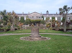 Mount StewartHeritage attraction · 1.4 mi
 Lake Walk, Mount StewartWalking route · 1.6 mi
 'Tir N'an Og' burial groundGraveyard · 1.7 mi
Explorer Tom Tir N'an Og burial ground at Mount Stewart is where the fancy folks went to nap forever. There's a tall tale about a hidden tunnel straight to the pub, but nobody’s found it yet. Go now, before it gets famous.
Tir n'an OgCemetery · 1.7 mi Cross IslandIslet · 2.0 mi
 Ringneill QuayBay · 2.0 mi
 Stone quay in RingneillStone Quay · 2.0 mi
Explorer Tom Stone quay in Ringneill had a feud with the next village over who owned the best fish. They never settled it. Ideal stop for a big stretch and a bigger yawn, especially if you're tired of their drama.
 Grey Abbey HouseCastle · 2.2 mi
More islands in County Down · All of County Down

What do you know about this place?Tap to add a comment or ask a question