What is recorded here
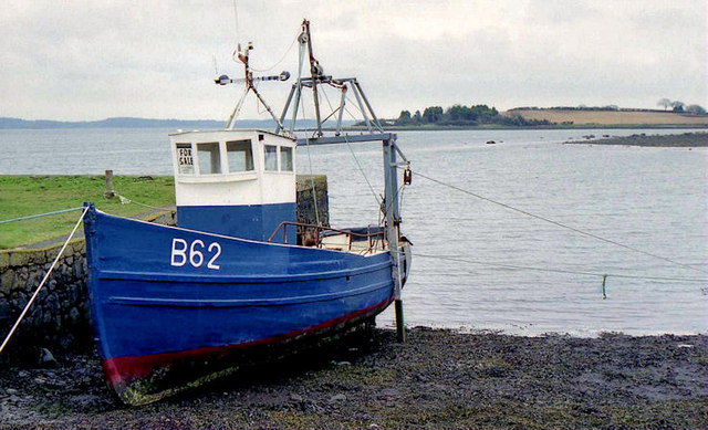
Stone quay in Ringneill is a stone quay in County Down, Ireland.
From the Northern Ireland Sites and Monuments Record record MRD168:114
The monument record does not grant public access. Check the route and ask the landowner before entering private land.
- What survives
- Recorded monument
Places near here
 Ringneill QuayBay · 6 yd
 Reagh IslandIsland · 802 yd
 Cross IslandIslet · 979 yd
 Island Reagh, Strangford LoughWalking route · 1079 yd
.JPG/250px-Mahee_Castle,_January_2011_(01).JPG "Photo: Ardfern, Wikimedia Commons · CC BY-SA 3.0") Mahee CastleCastle · 1560 yd
Mahee CastleCastle · 1560 yd Tower-house and bawn: mahee island in Mahee IslandTower-house and Bawn: Mahee Island · 1562 yd
 The Round TowerVisitor information · 1.1 mi
 Nendrum monastic site in Mahee IslandNendrum Monastic Site · 1.1 mi
 Post-Medieval church & graveyard in TullynakillPost-Medieval church & graveyard · 1.4 mi
 Stone pier in Castle EspieStone Pier · 2.0 mi
 Brickworks; cf ihr 2781 in Castle EspieBrickworks · 2.0 mi
 Castle Espie Wetland CentreNature reserve · 2.1 mi
Pictures: Albert Bridge, Geograph · CC BY-SA 2.0; Ardfern, Wikimedia Commons · CC BY-SA 3.0; N Chadwick, Geograph · CC BY-SA 2.0; Pulsar.co.nr, Wikimedia Commons · CC BY-SA 3.0; Christine Johnstone, Geograph · Creative Commons Attribution-ShareAlike 2.0; Christine Johnstone, Geograph · CC BY-SA 2.0; User:SeamusSweeney, Wikimedia Commons · CC BY-SA 3.0
More archaeology and monuments in County Down · All of County Down
What do you know about this place?